
Sutlej
| Sutlej | |
|---|---|
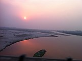
 View of Sutlej River | |
 Path of the Sutlej | |
| Location | |
| Country | China,India,Pakistan |
| State | Tibet,Himachal Pradesh,Punjab (India),Punjab (Pakistan) |
| Cities | Kalpa,Ludhiana,Vehari,Jallah Jeem,Bahawalpur |
| Physical characteristics | |
| Source | Manasarovar-Rakas Lakes |
| • location | Tibet |
| • coordinates | 30°50′39″N81°12′17″E/ 30.84417°N 81.20472°E |
| • elevation | 4,575 m (15,010 ft) |
| Mouth | Confluence withChenabto form thePanjnad River |
• location | NearKhairpur,Bahawalpur district,Punjab,Pakistan |
• coordinates | 29°23′23″N71°3′42″E/ 29.38972°N 71.06167°E |
• elevation | 102 m (335 ft) |
| Length | 1,450 km (900 mi) approx. |
| Basin size | 395,000 km2(153,000 sq mi)approx. |
| Discharge | |
| • location | Ropar[1] |
| • average | 500 m3/s (18,000 cu ft/s) |
| Discharge | |
| • location | Panjnad,Confluence ofChenab(71 km upstream of mouth) |
| • average | 2,946.66 m3/s (104,060 cu ft/s)[2] 63.613 km3/a (2,015.8 m3/s) |
| Basin features | |
| Tributaries | |
| • left | Baspa |
| • right | Spiti,Beas,Chenab |
TheSutlej River(/ˈsʌtlədʒ/) is the longest of the five rivers that flow through the historic crossroads region ofPunjabin northernIndiaandPakistan.The Sutlej River is also known asSatadru.[3]It is the easternmosttributaryof theIndus River.TheBhakra Damis built around the river Sutlej to provide irrigation and other facilities to the states of Punjab,RajasthanandHaryana.
The waters of the Sutlej are allocated to India under theIndus Waters Treatybetween India and Pakistan, and are mostly diverted to irrigation canals in India like theSirhind Canal,Bhakra Main Line and theRajasthan canal.[4]The mean annual flow is 14 million acre feet (MAF) (roughly 1.727 × 10¹³L) upstream ofRopar barrage,downstream of the Bhakra dam.[5]It has several major hydroelectric points, including the 1,325MWBhakra Dam,the 1,000 MWKarcham Wangtoo Hydroelectric Plant,and the 1,500 MWNathpa Jhakri Dam.[6][unreliable source?]Thedrainage basinin India includes the states and union territories of Himachal Pradesh, Punjab, Ladakh and Haryana.[7][8]
Course[edit]
The source of the Sutlej is west of thecatchment areaofLake RakshastalinTibet,as springs in anephemeralstream. Lake Rakshastal used to be part of the Sutlej river basin long ago and separated from the Sutlej due to tectonic activity. The nascent river flows at first west-northwest for about 260 kilometres (160 mi) under the Tibetan nameLangqên Zangbo(Elephant RiverorElephant Spring) to theShipki Lapass, entering India inHimachal Pradeshstate. It then has its mainkneeheading west-southwest for about 360 kilometres (220 mi) to meet theBeas RivernearHarike,Tarn Taran district,Punjabstate.Ropar WetlandinPunjabstate is located on the Sutlej river basin. Evidence suggestsIndus Valley civilisationalso flourished here. Ungti Chu and Pare Chu rivers which drain the southeastern part ofLadakhare tributaries of Sutlej river.[8][9]
Continuing west-southwest, the Sutlej enters Pakistan about 15 kilometres (9.3 mi) east ofBhedian Kalan,Kasur District,Punjabprovince, continuing southwest to water the ancient and historical formerBahawalpur princely state.[citation needed]Few centuries ago, Sutlej river was merging with theGhaggar riverto discharge in to the Arabian sea. In approx. 1797 BC, the course of the Sutlej river moved towards the north to join theBeas river.[10]
About 17 kilometres (11 mi) north ofUch Sharif,the Sutlej unites with theChenab River,forming thePanjnad River,which finally flows into the Indus river about 100 kilometres (62 mi) west of the city ofBahawalpur.The area to the southeast on the Pakistani side of the Indian border is called theCholistan Desertand, on the Indian side, theThar Desert.[citation needed]
The Indus then flows through agorgenearSukkurand the fertile plains region ofSindh,forming a large delta region between the border ofGujarat,India and Pakistan, finally terminating in theArabian Seanear theportcity ofKarachi,Pakistan. During floods, Indus river water flows into the Indian part of theGreat Rann of Kutch.Thus Gujarat state of India is also a riparian state of the Indus river as theRann of Kutcharea lying west ofKori Creekin the state is part of theIndus River Delta.[11]
Puranic Mention and Etymology[edit]
In the Chaitra-Ratha Parva ofAdi ParvaofMahābhārata,when sageVasishthawanted to commit suicide he saw the river named Haimāvata (whose source is Himavat), flooded and full of crocodiles and other aquatic monsters. So he jumped into the river. The river thinking that Vasishtha was a mass of unquenchable fire dilated itself and flew in a hundred different directions. Henceforth the river was named śatadra (or śatadru) which means the river of a hundred courses. So, Vasishtha landed on dry land and was unharmed.[12]
Langqên Zangbo[edit]
| Langqên Zangbo Lãng khâm tàng bố | |
|---|---|
 The Langqên Tsangpo (Sutlej River) seen from Tsaparang, Ngari, Tibet | |
| Native name | གླང་ཆེན་གཙང་པོ(Standard Tibetan) |
| Location | |
| Country | China |
| State | Tibet |
| Region | Ngari Prefecture |
| Physical characteristics | |
| Source | |
| • location | China |
| Length | 309 km (192 mi) |
| Basin features | |
| River system | Sutlej |
Langqên Zangbo(Tibetan:གླང་ཆེན་གཙང་པོ,Wylie:glang chen gtsang po;Chinese:Lãng khâm tàng bố;pinyin:Lǎngqīn Zàngbù) is a river inNgari,Tibet,China.The nameLangqên,Tibetan for "elephant", is because of a valley that resembles an elephant trunk. This river is the main source of the Sutlej, a tributary ofIndus River.It entersIndiaatShipki Lapass. The source is south ofGangdise Range,in Ngari Prefecture. Its course is mainly in theZanda County.The river drains an area of 22,760 km2,and covers a length of 309 km. The drop in height is 3,256 m. Historically, the river was the centre of theZhangzhungKingdom until its fall in the 8th century AD.
Geology[edit]
Sutlej is anantecedent river,which existed before the Himalayas andentrenched itselfwhile they were rising. The Sutlej, along with all of the Punjab rivers, is thought to have drained east into theGangesprior to 5mya.[13]
There is substantial geologic evidence to indicate that prior to 1700 BC, and perhaps much earlier, the Sutlej was an important tributary of theGhaggar-Hakra River(thought to be the legendarySarasvati River) rather than the Indus, with various authors putting the redirection from 2500 to 2000 BC,[14]from 5000 to 3000 BC,[15]or before 8000 BC.[16]Geologists believe thattectonic activitycreated elevation changes which redirected the flow of Sutlej from the southeast to the southwest.[17][citation needed]If the diversion of the river occurred recently (about 4000 years ago), it may have been responsible for the Ghaggar-Hakra (Saraswati) drying up, causingdesertificationofCholistanand the eastern part of the modern state ofSindh,and the abandonment ofHarappan settlementsalong the Ghaggar. However, the Sutlej may have already beencapturedby the Indus thousands of years earlier.[citation needed]
There is some evidence that the high rate of erosion caused by the modern Sutlej River has influenced the local faulting and rapidly exhumed rocks aboveRampur.[18]This would be similar to, but on a much smaller scale than, the exhumation of rocks by the Indus River inNanga Parbat,Pakistan. The Sutlej River also exposes a double invertedmetamorphic gradient.[19]
Sutlej-Yamuna Link[edit]
There has been a proposal to build a 214-kilometre (133 mi) long heavy freight and irrigation canal, to be known as theSutlej-Yamuna Link(SYL) to connect the Sutlej andYamunarivers.[20]The project is intended to connect the Ganges, which flows to the east coast of the subcontinent, with points west, via Pakistan. When completed, the SYL would enable inland shipping from India's east coast to its west coast (on the Arabian sea) without having to round the southern tip of India by sea, vastly shortening shipping distances, alleviating pressures on seaports, avoiding sea hazards, creating business opportunities along the route, raising real estate values, raising tax revenue, and establishing important commercial links and providing jobs for north-central India's large population. However, the proposal has met with obstacles and has been referred to theSupreme Court of India.To augment nearly 100tmcft(some 2.832 × 10¹²L) water availability for the needs of this link canal,Tso Moririlake/Lingdi Nadi (a tributary of Tso Moriri lake) waters can be diverted to the Sutlej basin by digging a 10 km=long gravity canal to connect to the Ungti Chu river.[8]
History[edit]
This sectionneeds additional citations forverification.(August 2015) |
The Upper Sutlej Valley, calledLangqên ZangboinTibet,was once known as theGarudaValley by theZhangzhung,the ancient civilization of westernTibet.The Garuda Valley was the centre of their empire, which stretched many miles into the nearbyHimalayas.The Zhangzhung built a towering palace in the Upper Sutlej Valley calledKyunglung,the ruins of which still exist today near the village ofMoincêr,southwest ofMount Kailash(Mount Ti-se). Eventually, the Zhangzhung were conquered by theTibetan Empire.The Sutlej River also formed the eastern boundary of theSikh Empireunder MaharajahRanjit Singh.Parganah Hakkarah
Today, the Sutlej Valley is inhabited by nomadic descendants of the Zhangzhung, who live in tiny villages ofyakherders.[citation needed]
The Sutlej was the main medium of transportation for the kings of that time. In the early 18th century, it was used to transportdevdarwoods forBilaspur district,Hamirpur district,and other places along the Sutlej's banks.[citation needed]
Of four rivers (Indus,Sutlej,BrahmaputraandKarnali/Ganges) mythically flowing out of holyLake Manasarovar,the Sutlej is actually connected by channels that are dry most of the time. Earlier the river was also called Shutudri or Zaradros river.[21]
Gallery[edit]
-
 Sutlej Valley fromRampurc. 1857
 -
 Using inflated animal skins to cross the Sutlej River, c. 1905
 -
 Sutlej River inKinnaurValley, Himachal Pradesh, India
 -
 Cattle grazing on the banks of the river inRupnagar,Punjab, India
 -
 Satluj River near Shahkot, Punjab, India
 -
 Sutlej entering India from Tibet nearShipki La,c. 1856


See also[edit]
- List of rivers of India
- List of rivers of Pakistan
- Cis-Sutlej states
- Sulemanki Headworks
- Geology of the Himalaya
References[edit]
- ^"Sutlej valley".The Free Dictionary.
- ^"Rivers Network".2020. Archived fromthe originalon 8 August 2022.Retrieved10 March2022.
- ^Asiatic Society of Bengal (1848).Journal of the Asiatic Society of Bengal, Volume 17, Part 1.p. 210, paragraph two.
- ^"Bhakra Beas Management Board".wrmin.nic.in.Archived fromthe originalon 31 August 2005.
- ^"Page 290, The Ravi- Beas Water Tribunal Report (1987)"(PDF).Central Water Commission.Retrieved15 February2020.
- ^"Nathpa Jhakri Hydroelectric Power Project, India".power-technology.Retrieved14 May2011.
- ^"Lower Sutlej basin area"(PDF).Archived fromthe original(PDF)on 4 September 2018.Retrieved14 May2017.
- ^abc"WRIS geo-visualization map".Archived fromthe originalon 13 June 2017.Retrieved17 January2017.
- ^"Upper Sutlej basin area"(PDF).Archived fromthe original(PDF)on 7 January 2018.
- ^"Page 60, The Ravi- Beas Water Tribunal Report (1987)"(PDF).Central Water Commission.Retrieved15 February2020.
- ^"Evolution of the Delta, the LBOD outfall system and the Badin dhands - chapters 3 & 4"(PDF).Retrieved22 December2015.
- ^Pratap Chandra Roy's Mahabharata Adi Parva, Chaitra-Ratha Parva Page:509
- ^Clift, Peter D.; Blusztajn, Jerzy (15 December 2005). "Reorganization of the western Himalayan river system after five million years ago".Nature.438(7070): 1001–1003.Bibcode:2005Natur.438.1001C.doi:10.1038/nature04379.PMID16355221.S2CID4427250.
- ^Mughal, M. R. Ancient Cholistan. Archaeology and Architecture. Rawalpindi-Lahore-Karachi: Ferozsons 1997, 2004
- ^Valdiya, K. S., in Dynamic Geology, Educational monographs published by J. N. Centre for Advanced Studies, Bangalore, University Press (Hyderabad), 1998.
- ^* Clift et al. 2012. "U-Pb zircon dating evidence for a Pleistocene Sarasvati River and capture of the Yamuna River." Geology, v. 40.[1]
- ^K.S. Valdiya. 2013. "The River Saraswati was a Himalayan-born river". Current Science 104 (01).[2]
- ^Thiede, Rasmus; Arrowsmith, J. Ramón; Bookhagen, Bodo; McWilliams, Michael O.; Sobel, Edward R.; Strecker, Manfred R. (August 2005). "From tectonically to erosionally controlled development of the Himalayan orogen".Geology.33(8): 689–692.doi:10.1130/G21483AR.1.
- ^Grasemann, Bernhard; Fritz, Harry; Vannay, Jean-Claude (July 1999). "Quantitative kinematic flow analysis from the Main Central Thrust Zone (NW-Himalaya, India): implications for a decelerating strain path and the extrustion of orogenic wedges".Journal of Structural Geology.21(7): 837–853.Bibcode:1999JSG....21..837G.doi:10.1016/S0191-8141(99)00077-2.
- ^http://india.gov.in/sectors/water_resources/sutlej_link.phpSutlej-Yamuna Link
- ^"Sutlej River | river, Asia | Britannica".
External links[edit]
- Sutlej basinmarked on OpenStreetMap.
- Sutlej-Yamuna Link Canal is So Controversial?Wissurge,26 August 2020

| Rivers | |
|---|---|
| Lakes |
|
| Dams, barrages | |
| Yangtzesystem | |
|---|---|
| Yellowsystem | |
| Pearlsystem | |
| Heilong gian gsystem | |
| Huaisystem | |
| Haisystem | |
| Liaosystem | |
| Other major rivers |
|
| Major canals | |
| International | |
|---|---|
| National | |