
Tamsui District
Tamsui, Taiwan
Nước ngọt khu Tansui, Danshuei, Tanshui, Danshui | |
|---|---|
       | |
 Tamsui District inNew Taipei City | |
| Coordinates:25°10′19″N121°26′38″E/ 25.17194°N 121.44389°E | |
| Country | |
| Special municipality | New Taipei City,Taiwan |
| Area | |
| • Total | 70.65 km2(27.28 sq mi) |
| Population (February 2023) | |
| • Total | 189,271 |
| • Density | 2,299/km2(5,950/sq mi) |
| Time zone | +8 |
| Website | www |
| Tamsui | |||||||||||||||||||||||||||||||||||
|---|---|---|---|---|---|---|---|---|---|---|---|---|---|---|---|---|---|---|---|---|---|---|---|---|---|---|---|---|---|---|---|---|---|---|---|
 Tamsui District office | |||||||||||||||||||||||||||||||||||
| Chinese name | |||||||||||||||||||||||||||||||||||
| Chinese | Nước ngọt | ||||||||||||||||||||||||||||||||||
| Postal | Tamsui | ||||||||||||||||||||||||||||||||||
| |||||||||||||||||||||||||||||||||||
| Hobe | |||||||||||||||||||||||||||||||||||
| Traditional Chinese | Hỗ đuôi | ||||||||||||||||||||||||||||||||||
| |||||||||||||||||||||||||||||||||||
| Japanese name | |||||||||||||||||||||||||||||||||||
| Kanji | Nước ngọt | ||||||||||||||||||||||||||||||||||
| Kana | たんすい | ||||||||||||||||||||||||||||||||||
| |||||||||||||||||||||||||||||||||||
Tamsui District[1][2][3][4](Chinese:Nước ngọt;pinyin:Dànshuǐ;Pe̍h-ōe-jī:Tām-chúi;Tâi-lô:Tām-tsuí) is a seasidedistrictinNew Taipei City,Taiwanadjacent to theTamsui Riverand overlooking theTaiwan Strait.The name of the district means "fresh water" in Chinese. Although modest in size (population 189,271), Tamsui plays a significant role in Taiwanesehistoryandculture.
Name
[edit]Historical
[edit]TheKetagalanaboriginescalled the location around modern TamsuiHoba,meaning "stream's mouth."Hobatransliterated intoTaiwanese HokkienasHobe.Historical works in English have referred to the place as "Hobe,"[5]"Hobé,"[6]or "Hobe Village."[7]17th-century Spanish colonists labeled the regionCasidorand the Tamsui RiverKimalon.Dutch records reference the namesTamsuyandTampsuibut also refer to another "Lower Tamsuy"in southern Taiwan.[8]
PastorGeorge Leslie Mackaypopularized "Tamsui" as the English-language transliteration in his 1895 bookFrom Far Formosa.[9]"Tamsui" is consistent withHokkienliterary readings,[10][11]and (possibly by chance) is equal to the Church Romanization of an older pronunciation (Tām-súi) minus tone markings and hyphen.[12]By 1900, the "Tamsui" variant was already well-known[13]and featured prominently in two English-language maps of the area.[14]However, some naming confusion persisted, as evidenced byUnited StatesdiplomatJames W. Davidson's1903 bookThe Island of Formosa.Davidson lists "Tamsui, Tamshuy, Tamshui, Tamsoui, [and] Tan-sui" as acceptable spellings and pronunciations.[6]
Historically, the term "Tamsui" is ambiguous, as "it may mean the harbor, the river, the village of Hobe,Twatutia,orBanka,and it may mean the whole district. "[15]
Modern
[edit]From 1950 until the 2010 creation of New Taipei City, Tamsui was officially "TamsuiTownship"(Chinese:Nước ngọt trấn;HokkienPOJ:Tām-chúi-tìn;HokkienTâi-lô:Tām-tsuí-tìn) in the formerTaipei County.The spelling "Danshui" (fromHànyǔ PīnyīnDànshuǐ), formerly used officially by the Taiwan government,Taipei Metro,and other sources, is based on theMandarinpronunciation. Having long used "Tamsui" as the official English name,[citation needed]the local government of the district informed thenational governmentin 2011 that "Tamsui" rather than "Danshui" should be used in English.
History
[edit]
Spanish colony
[edit]TheSpanisharrived in the area of Tamsui in the 17th century. In the fall of 1629, the Spanish established the first major non-aboriginal settlement comprising the town and mission ofSanto Domingo.The Spanish occupied northernTaiwanfor the purpose of securing Spanish interests in thePhilippinesagainst theDutch(who were already established in the South of Taiwan by then), theBritish,and thePortuguese,as well as for facilitating trade with China and Japan.
In 1642, the Spanish were expelled from Taiwan by the Dutch. The Spanish had already abandoned their settlement in Tamsui in 1638 and the Dutch built a new fort which they named Fort Anthonio (after the Governor-General of the Dutch East India Company Anthonio van Diemen). It is today known asAngmoSiaa(Chinese:Hồng mao thành;Pe̍h-ōe-jī:Âng-mn̂g-siâⁿ;lit.'red-hair fortress') and is the main building of theFort San Domingomuseum complex. In addition to "pacifying" the aboriginal tribes in the area, the Dutch also encouraged the immigration and settlement of the area byHan Chinese,as well as expanding the production and trade ofsulfur,animal skins, and other indigenous resources.
The Dutch left Fort Zeelandia in Taiwan in 1662 following their defeat byKo xing aat theSiege of Fort Zeelandia,who continued the policy of increasingHan Chineseimmigration until the surrender of his grandsonZheng Keshuangto theQing Dynastyin 1683. In 1668, the Dutch leftKeelungafter getting harassed by aboriginals from Tamsui.[16]
Qing dynasty
[edit]
Because of its proximity tomainland China,as well as its location in a natural harbor, Tamsui quickly became a major fishing and trade port. The Qing naval patrol also established an outpost in Tamsui in 1808. In 1862, theQinggovernment opened Tamsui to foreign trade under the terms of theTreaty of Tientsin,exportingtea,camphor,sulfur,coal,opium,and dyes. By the mid-19th century Tamsui had become the largest port inTaiwan,boasting a sizable foreign population as well as aBritishconsulate at Fort Santo Domingo.[17][18]

Canadianmedical doctor and missionaryGeorge Leslie Mackayarrived in Tamsui on 9 March 1872, proceeding to establish Taiwan's first hospitals in Western medicine and formal educational facilities, including Oxford College (now part ofAletheia University), the oldest European-style higher-education institution in Taiwan by some measure.
During theSino-French Warthe French attempted an invasion of Taiwan during theKeelung Campaign.Liu Mingchuan,who was leading the defence of Taiwan, recruited Aboriginals to serve alongside the Chinese soldiers in fighting against the French. The French were defeated at theBattle of Tamsui,and the Qing forces pinned the French down at Keelung in an eight-month-long campaign before the French withdrew.
In 1884, the harbour of Tamsui was blockaded by theFrench Navyunder the command of AdmiralAmédée Courbet,during theSino-French War.[19]The French were defeated at theBattle of Tamsuiby the Chinese and, according to traditional accounts, with the divine assistance of the GoddessMazu.
Japanese rule
[edit]
By the time Taiwan was ceded to Japan following the end of theSino-Japanese Warin 1895, Tamsui's position as a seaport was beginning to wane due to the accumulation of sediments in theTamsui River.By the 20th century, most of Tamsui's port operations had moved toKeelung,and the local economy had switched primarily toagriculture.However, public infrastructure construction projects by the Japanese led to Tamsui's rise as a local administrative and cultural center.
In the early years ofJapanese rule(1895–1945), the population of the city was nearly 6,000.[20]From 1920, under the prefecture system, Tamsui was called Tansui Town(Nước ngọt phố),and was governed under Tansui District ofTaihoku Prefecture.
Post-war
[edit]
Following the end ofWorld War IIin 1945, Tamsui reverted to being a small fishing town astownshipofTaipei County.With the expansion of nearbyTaipei City,Tamsui slowly became a center for tourism along Taiwan's northwest coast. In the last ten years, the city has become popular as a suburb of Taipei in the local real estate market.
Following the completion of theTaipei Metro'sTamsui Linein 1997, the town experienced a sharp increase in tourist traffic, reflected in the completion of several riverside parks, the growth of open-air markets specializing in traditional handicrafts and street-stall snacks, the construction of afisherman's wharf,and the increase in passenger ferries traversing across and along the river.
Administrative divisions
[edit]Tamsui District administers forty-twourban villages().[21]
| Division | Chinese[21][22] | Romanization (fromTongyong Pinyin)[23][24] |
Romanization (fromHanyu Pinyin)[25][24] |
Romanization (fromWade–Giles) |
Population (2010)[21] |
|---|---|---|---|---|---|
| Urban villages |
Trung hoà | Jhonghe[26] | Zhonghe[27] | Chung-ho[28] | 693 |
| Truân sơn | Tunshan | Tunshan | 1,229 | ||
| Hiền hiếu | Siansiao | Xianxiao | Hsien-hsiao | 1,736 | |
| Hưng nhân | Singren | Xingren | Hsing-jen | 1,749 | |
| Phiên khoai | Fanshu | Fanshu | Fan-shu | 1,076 | |
| Nghĩa sơn | Yishan | Yishan | I-shan | 2,820 | |
| Trung sơn | Jhongshan | Zhongshan | Chung-shan | 1,026 | |
| Khám đỉnh | Kanding | Kanding | K’an-ting | 2,632 | |
| Bì đảo | Pidao | Pidao | P’i-tao | 1,312 | |
| Mới phát | Sinsing | Xin xing | Hsin-hsing | 6,547 | |
| Cối đá giã gạo bằng sức nước | Shueiduei[29] | Shuidui | Shui-tui | 6,304 | |
| Bắc đầu | Beitou | Beitou | Pei-t’ou | 5,779 | |
| Nguồn nước | Shueiyuan | Shuiyuan | Shui-yüan | 2,516 | |
| Trung liêu | Jhongliao | Zhongliao | Chung-liao | 1,354 | |
| Thụ hưng | Shusing | Shu xing | Shu-hsing | 1,165 | |
| Bình đỉnh | Pingding | Pingding | P’ing-ting | 1,411 | |
| Phúc đức | Fude | Fude | Fu-te | 6,574 | |
| Trúc vây | Jhuwei | Zhuwei | Chu-wei | 6,322 | |
| Dân sinh | Minsheng | Minsheng | Min-sheng | 6,774 | |
| Tám thế | Bashih | Bashi | Pa-shih | 4,374 | |
| Can trăn | Ganjhen | Ganzhen | Kan-chen | 7,890 | |
| Đặng công | Denggong | Denggong | 6,355 | ||
| Trung hưng | Jhongsing | Zhong xing | Chung-hsing | 4,613 | |
| Sao Hôm | Changgeng | Changgeng | 1,686 | ||
| Thanh văn | Cingwun | Qingwen | 1,320 | ||
| Thảo đông | Caodong | Caodong | 901 | ||
| Hiệp nguyên | Sieyuan | Xieyuan | 1,749 | ||
| Vĩnh cát | Yongji | Yongji | 1,018 | ||
| Dân an | Min-an | Minan/Min'an | 930 | ||
| Tân sinh | Sinsheng | Xinsheng | Hsin-sheng | 999 | |
| Văn hóa | Wunhua | Wenhua | 2,133 | ||
| Du xe | Youche | Youche | Yu-ch’e | 5,628 | |
| Sa luân | Shalun | Shalun | Sha-lun | 3,499 | |
| Tân nghĩa | Sinyi | Xinyi | Hsin-i | 4,658 | |
| Tân xuân | Sinchun | Xinchun | 6,870 | ||
| Tân dân | Sinmin | Xinmen | Hsin-min | 4,960 | |
| Chính Đức | Jhengde | Zhengde | Cheng-te | 4,482 | |
| Bắc tân | Beisin | Beixin | Pei-hsin | 2,907 | |
| Dân quyền | Mincyuan | Minquan | Min-ch’uan/Min-ch’üan | 3,940 | |
| Hạnh phúc | Singfu | Xingfu | Hsing-fu | 4,742 | |
| Học phủ | Syuefu | Xuefu | 4,357 | ||
| Đại trang | Dajhuang | Dazhuang | 4,451 |
Climate
[edit]| Climate data for Tamsui District (1991–2020 normals, extremes 1942–present ) | |||||||||||||
|---|---|---|---|---|---|---|---|---|---|---|---|---|---|
| Month | Jan | Feb | Mar | Apr | May | Jun | Jul | Aug | Sep | Oct | Nov | Dec | Year |
| Record high °C (°F) | 28.4 (83.1) |
29.0 (84.2) |
31.9 (89.4) |
33.6 (92.5) |
35.8 (96.4) |
37.3 (99.1) |
38.8 (101.8) |
38.5 (101.3) |
37.4 (99.3) |
35.8 (96.4) |
32.8 (91.0) |
30.5 (86.9) |
38.8 (101.8) |
| Mean daily maximum °C (°F) | 18.8 (65.8) |
19.3 (66.7) |
21.6 (70.9) |
25.4 (77.7) |
28.8 (83.8) |
31.3 (88.3) |
33.3 (91.9) |
33.1 (91.6) |
30.9 (87.6) |
27.1 (80.8) |
24.4 (75.9) |
20.6 (69.1) |
26.2 (79.2) |
| Daily mean °C (°F) | 15.4 (59.7) |
15.7 (60.3) |
17.7 (63.9) |
21.4 (70.5) |
24.7 (76.5) |
27.3 (81.1) |
29.0 (84.2) |
28.7 (83.7) |
26.9 (80.4) |
23.6 (74.5) |
21.0 (69.8) |
17.3 (63.1) |
22.4 (72.3) |
| Mean daily minimum °C (°F) | 12.7 (54.9) |
13.0 (55.4) |
14.7 (58.5) |
18.3 (64.9) |
21.6 (70.9) |
24.2 (75.6) |
25.7 (78.3) |
25.5 (77.9) |
23.8 (74.8) |
20.9 (69.6) |
18.3 (64.9) |
14.6 (58.3) |
19.4 (66.9) |
| Record low °C (°F) | 2.3 (36.1) |
3.2 (37.8) |
3.1 (37.6) |
6.7 (44.1) |
13.4 (56.1) |
15.4 (59.7) |
20.4 (68.7) |
19.6 (67.3) |
15.5 (59.9) |
10.6 (51.1) |
7.6 (45.7) |
4.2 (39.6) |
2.3 (36.1) |
| Averageprecipitationmm (inches) | 105.9 (4.17) |
148.0 (5.83) |
153.4 (6.04) |
157.6 (6.20) |
239.8 (9.44) |
257.4 (10.13) |
119.8 (4.72) |
218.3 (8.59) |
290.1 (11.42) |
165.8 (6.53) |
104.2 (4.10) |
112.4 (4.43) |
2,072.7 (81.6) |
| Average precipitation days(≥ 0.1 mm) | 13.9 | 13.8 | 15.2 | 13.6 | 12.6 | 12.2 | 8.3 | 10.9 | 11.8 | 12.3 | 12.4 | 12.5 | 149.5 |
| Averagerelative humidity(%) | 80.8 | 82.4 | 81.0 | 79.9 | 79.2 | 79.9 | 75.0 | 76.0 | 76.1 | 77.8 | 78.5 | 79.0 | 78.8 |
| Mean monthlysunshine hours | 83.1 | 80.4 | 92.7 | 105.9 | 135.6 | 155.9 | 226.9 | 208.6 | 171.7 | 127.5 | 101.9 | 84.1 | 1,574.3 |
| Source: Central Weather Bureau[30][31][32][33][34] | |||||||||||||
Education
[edit]- Aletheia University
- St. John's University
- Tamkang University
- Taipei University of Marine Technology
- New Taipei Municipal Tam-Shui Vocational High School
- New Taipei Municipal Zhuwei High School
- Tamshui Junior High School
Tourist attractions
[edit]

- Drop of Water Memorial Hall
- Former British Merchant Warehouse
- Fort San Domingo
- Hobe Fort
- Museum of Tamsui Fishiegoodies
- Tamsui Art Gallery
- Tamsui Church
- Tamsui Customs Officers' Residence
- Tamsui Customs Wharf
- Tamsui Fisherman's Wharf
- Tamsui Fuyou Temple
- Tamsui Historical Museum
- Tamsui Lover's Bridge
- Tamsui Lungshan Temple
- Tamsui Meteorological Observatory
- Tamsui Old Street
- Tamsui Qingshui Temple
- Tamsui Qingshui Deity's Grand Procession, on 6th day of 5th lunar month, an important fiesta for Tamsui District
- Tamsui Red Castle
- Teng Feng Fish Ball Museum
Transportation
[edit]
Taipei Metro
[edit]Light rail
[edit]Sister city
[edit]Notable natives
[edit]- Joe Hung,representativeto Italy (1993–2000)
- Tu Tsung-ming,former physician
Gallery
[edit]-
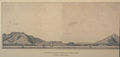 A French sketch of Tamsui in 1893
 -
 Tamsui Port, circa 1970
 -
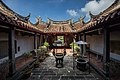 The Yinshan Temple in Tamsui, 2018
 -
 Tamsui Harbor (Li Mei-shu,1930)
 -
 Tamsui (Tan Ting-pho,1935) – 91 × 116.5 cm – Taiwan Museum of Fine Arts
 -
 Tamsui Church (Ni Chiang-huai, 1936) – Paper, watercolor – 49.5 × 66 cm – Taipei Museum of Fine Arts
 -
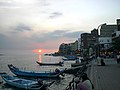 Tamsui waterfront at sunset
 -
 The sunset in front of the Long Pier of Tamsui


Sources
[edit]- History sectionretrieved and translated fromTamsui District office website.
Notes
[edit]- ^"About Tamsui".Tamsui District Office, New Taipei City Government.Retrieved13 July2019.
Tamsui District
- ^Đài Loan khu vực hương trấn nội thành cấp trở lên khu vực hành chính tên trung anh đối chiếu biểu(PDF).Online Translation System of Geographic Name,Ministry of Interior.16 June 2011. p. 1. Archived fromthe original(PDF)on 25 March 2012.
Nước ngọt khu Tamsui District “Nước ngọt” y quốc tế thông dụng, ước định mà thành phương thức dịch viết
- ^Edward Stanford (1908).Atlas of the Chinese Empire(1 ed.). pp.2,13– viaInternet Archive.
Tamsui
{...}
Tamsui, Formosa.. 25.11 N 121.26 E - ^Index to Map of China(2 ed.).Shanghai:Far Eastern Geographical Establishment. 1915. p.86– viaInternet Archive.
Tamsui......... Đam châu [sic] Formosa... Đài Loan... 25.11 N 121.26 E
- ^Davidson (1903),p. 310.
- ^abDavidson (1903),p. 261.
- ^Davidson (1903),p. 310 (illustration).
- ^Campbell, William(1903)."Explanatory Notes".Formosa under the Dutch: described from contemporary records, with explanatory notes and a bibliography of the island.London: Kegan Paul. p. 548.OCLC644323041.
- ^"Tên dịch nháo song bao nước ngọt chính danh Tamsui".2011-08-05.Retrieved2023-10-27.
- ^"Entry #824 ( thủy )".Đài Loan Mân Nam ngữ thường dùng từ từ điển[Dictionary of Frequently-Used Taiwan Minnan]. (in Chinese and Hokkien).Ministry of Education, R.O.C.2011.
- ^Iûⁿ, Ún-giân.Đài ngữ tuyến đỉnh từ điển[Taiwanese Online Character Dictionary].
- ^Douglas, Carstairs(1899).Chinese-English dictionary of the vernacular or spoken language of Amoy(2nd ed.). London: Presbyterian church of England. p.473.OCLC5516636.OL25126855M.
- ^Davidson (1903),p. iii: "In later chapters describing the island under Japanese rule, and in the map, the Japanese name is given first, and the Chinese in brackets, with the exception of a few well-known names such asKelung,Takow,etc., and some English names of islands in the Pescadores. "(Note:" Tansui "is not found until the index and is absent from the map)
- ^see, for example:
- Campbell, William(August 1896)."The island of Formosa: Its past and future".Scottish Geographical Magazine.12(8).map.doi:10.1080/00369229608732903.
- Davidson (1903),map
- ^Davidson (1903),p. 261: "The term Tamsui is used in a most liberal way; it may mean the harbor, the river, the village of Hobe, Twatutia, or Banka, and it may mean the whole district. Properly it is but the name of a river. A resident of Twatutia may likewise describe himself as a residient either of Twatutia, Taipehfu, or Tamsui, and still be quite correct so far as custom goes, although ordinarily the merchants and consuls, whether at Hobe or Twatutia, use Tamsui as their address."
- ^Shepherd, John Robert (1993).Statecraft and political economy on the Taiwan frontier, 1600–1800.Stanford University Press. p. 95.ISBN9780804720663.
- ^NEVILLE-HADLEY, PETER (2014)."Sleepy Tamsui Once a Thriving Treaty Port".Culture Locker.Meridian Writers’ Group.
- ^The consulate was closed on 13 March 1972 and returned to the authorities in 1980. SeeSino-British relations.
- ^Elleman, Bruce A. (2001).Modern Chinese warfare, 1795–1989.Routledge. p.89.ISBN9780415214735.
Following this setback, the Qing court officially declared war on France on 26 August 1884. On 1 October, Admiral Courbet landed at Jilong with 2,250 men, and the city fell to the French. Chinese forces continued to encircle Jilong throughout the rest of the War. Although a French blockade thwarted all subsequent Chinese efforts to send a fleet to relieve Taiwan, the French troops never succeeded in taking the riverside town of Danshui (Tamsui) in Taiwan's northwestern coastal plain, immediately north of modern-day Taipei. As a result, French control over Taiwan was limited merely to the northern coast. China's central fleet, based in Jiangsu Province, proved unable to break through Admiral Courbet's blockade of Taiwan. Although the south quickly requested assistance from the northern fleet, Li Hongzhang refused to place his own ships in danger. This decision almost guaranteed that China's coastal waters would be dominated by the French.
- ^Takekoshi (1907),p. 200.
- ^abcNgô minh dũng (ed.).Đệ nhất thiên duyên cách chí(PDF)(in Chinese (Taiwan)). pp. 83–84.Retrieved12 July2019.
Phụ biểu 17: 2010 năm 12 nguyệt nước ngọt trấn các dân cư bảng thống kê {...}42
- ^107 năm địa phương nhân viên chính phủ tuyển cử(in Chinese (Taiwan)).Central Election Commission.Retrieved12 July2019.
Trung hoà truân trong núi hiền hiếu hưng nhân phiên khoai nghĩa trong núi trung trong núi khám đỉnh bì đảo mới phát cối đá giã gạo bằng sức nước bắc đầu nguồn nước trung liêu thụ hưng bình đỉnh phúc đức trúc vây dân sinh tám thế can trăn Đặng km trung hưng sao Hôm thanh văn thảo đông hiệp nguyên vĩnh cát dân an tân sinh văn hóa du trong xe sa luân tân nghĩa tân xuân tân dân Chính Đức bắc tân dân quyền hạnh phúc học phủ đại trong trang
- ^"district+map.pdf"(PDF).Tamsui District Office, New Taipei City Government.Retrieved12 July2019.
[main]Tunshan Vlg. Siansiao Vlg. Jhonghe Vlg. Singren Vlg. Fanshu Vlg. Yishan Vlg. Jhongshan Vlg. Kanding Vlg. Jhongliao Vlg. Pidao Vlg. Shalun Vlg. Dajhuang Vlg. Sinchun Vlg. Shueiyuan Vlg. Beitou Vlg. Youche Vlg. Sinsing Vlg. Jhongde Vlg. Sinmin Vlg. Shueiduei Vlg. Beisin Vlg. Sinyi Vlg. Wunhua Vlg. Jhongsing Vlg. Syuefu Vlg. Shusing Vlg. Denggong Vlg. Sinfu[sic] Vlg. Ganjhen Vlg. Pingding Vlg. Bashih Vlg. Minsheng Vlg. Jhuwei Vlg. Mingcyuan Vlg. Fude Vlg. [inset] Wunhua Vlg. Sieyuan Vlg. Sinsheng Vlg. Yongji Vlg. Cingwun Vlg. Sinfu Vlg.[mislabeled; should be 'Changgeng Vlg.'] Min-an Vlg. Caodong Vlg. Sinfu[sic] Vlg.
(note that the transcription of the map is approximate; the map also includes some blatant errors) - ^ab"Map of Administrative Districts".Tamsui District Office, New Taipei City Government.Retrieved12 July2019.
Tamsui Include Tunshan Vlg. Jhonghe Vlg. Siansiao Vlg. Fansh[sic] Vlg.Singren Vlg. Yishan Vlg. Jhongshan Vlg. Kanding Vlg. Pidao Vlg.Jhongliao Vlg.Shueiyuan Vlg. Beitou Vlg. Shalun Vlg.Dazhung[sic] Vlg.Youche Vlg. Xinchun Vlg. Xin xing Vlg. Xinmin Vlg. Wenhua Vlg. Zhengde Vlg.Shuidui Vlg. Xinyi Vlg. Beixin Vlg. Jhongsing Vlg. Syuefu Vlg. Denggog[sic] Vlg. Sinfu Vlg. Shusing Vlg. Ganjhen Vlg. Xleyuan[sic] Vlg. Xinsheng Vlg. Uongli[sic] Vlg. Min-an Vlg. Cingwen Vlg. Changgeng Vlg. Caodong Vlg. pingding[sic] Vlg. Bashih Vlg. Minsheng Vlg. Jhuwei Vlg. Minocyuan[sic] Vlg. Fude Vlg.
(note that the list includes some blatant errors) - ^"2018 Local Elections".Central Election Commission.Retrieved12 July2019.
Zhonghe Vil. Tunshan Vil. Xianxiao Vil. Xingren Vil. Fanshu Vil. Yishan Vil. Zhongshan Vil. Kanding Vil. Beidao Vil. Xin xing Vil. Shuidui Vil. Beitou Vil. Shuiyuan Vil. Zhongliao Vil. Shu xing Vil. Pingding Vil. Fude Vil. Zhuwei Vil. Minsheng Vil. Bashi Vil. Ganzhen Vil. Denggong Vil. Zhong xing Vil. Zhanggeng[sic] Vil. Qingwen Vil. Caotung[sic] Vil. Xieyuan Vil. Yongji Vil. Minan Vil. Xinsheng Vil. Wenhua Vil. Youju[sic] Vil. Shalun Vil. Xinyi Vil. Xinchun Vil. Xinmin Vil. Zhengde Vil. Beixin Vil. Minquan Vil. Xingfu Vil. Xuefu Vil. Dazhuang Vil.
(note that the list includes some blatant errors) - ^Jhonghe (Variant – V)atGEOnet Names Server,United States National Geospatial-Intelligence Agency
- ^Zhonghe (Approved – N)atGEOnet Names Server,United States National Geospatial-Intelligence Agency
- ^Chung-ho (Variant – V)atGEOnet Names Server,United States National Geospatial-Intelligence Agency
- ^"Police Station".Retrieved12 July2019.
Shueiduei
- ^"Monthly Mean".Central Weather Bureau.Retrieved29 November2022.
- ^"Khí tượng trạm các tháng tối cao nhiệt độ không khí thống kê"(PDF)(in Chinese). Central Weather Bureau.Retrieved29 November2022.
- ^"Khí tượng trạm các tháng tối cao nhiệt độ không khí thống kê ( tục )"(PDF)(in Chinese). Central Weather Bureau.Retrieved29 November2022.
- ^"Khí tượng trạm các tháng thấp nhất nhiệt độ không khí thống kê"(PDF)(in Chinese). Central Weather Bureau.Retrieved29 November2022.
- ^"Khí tượng trạm các tháng thấp nhất nhiệt độ không khí thống kê ( tục )"(PDF)(in Chinese). Central Weather Bureau.Retrieved29 November2022.
- ^Guo, Elizabeth; Kennedy, Brian (10 July 2008)."Tale of two towns: Chico, Calif., and Tamsui, Taiwan, Republic of China, have more in common than you might think".Chico News & Review.Retrieved28 December2014.
Bibliography
[edit]- Davidson, James W.(1903).The Island of Formosa, Past and Present: history, people, resources, and commercial prospects: tea, camphor, sugar, gold, coal, sulphur, economical plants, and other productions.London and New York: Macmillan.OCLC1887893.OL6931635M.
- Takekoshi, Yosaburō(1907).Japanese rule in Formosa.London, New York, Bombay and Calcutta: Longmans, Green, and co.OCLC753129.OL6986981M.
External links
[edit] Tamsuitravel guide from Wikivoyage
- Official website

- Tamsui Historic Museum
- Why Tamsui people are called Tamsuian?
- Takao Club: The Tamsui Foreign Cemetery
- Tamsui Travel Guide
| International | |
|---|---|
| National | |