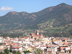
Tertenia
Appearance
Tertenia
Dardania | |
|---|---|
| Comune di Tertenia | |
 | |
| Coordinates:39°42′N9°35′E/ 39.700°N 9.583°E | |
| Country | Italy |
| Region | Sardinia |
| Province | Province of Nuoro(NU) |
| Government | |
| • Mayor | Giulio Murgia |
| Area | |
| • Total | 117.77 km2(45.47 sq mi) |
| Elevation | 129 m (423 ft) |
| Population (31 December 2015)[1] | |
| • Total | 3,888 |
| • Density | 33/km2(86/sq mi) |
| Demonym | Terteniesi |
| Time zone | UTC+1(CET) |
| • Summer (DST) | UTC+2(CEST) |
| Postal code | 08047 |
| Dialing code | 0782 |
| Patron saint | St. Sophia |
| Saint day | September 1 |
Terteniais acomune(municipality) in theProvince of Nuoroin theItalianregionSardinia,located about 70 kilometres (43 mi) northeast ofCagliariand about 25 kilometres (16 mi) south ofTortolì.
Tertenia borders the following municipalities:Cardedu,Gairo,Jerzu,Lanusei,Loceri,Osini,Ulassai.
It is located in a high valley at the base of Mt. Arbu and Mt. Ferru, along the Rio Quirra river.[2]
References
[edit]Wikimedia Commons has media related toTertenia.
- ^All demographics and other statistics: Italian statistical instituteIstat.
- ^"Tertenia".🏖️Sardinian Beaches.Retrieved2023-01-12.


