
Trois-Rivières
Trois-Rivières | |
|---|---|
| Ville de Trois-Rivières | |
 From top, left to right: Downtown Trois-Rivières from theSt. Lawrence River,monument to Sacré-Coeur, Trois-Rivières Cathedral,Laviolette Bridge,Pacifique Du Plessis gate, Ursulines monastery | |
 Flag  Coat of arms  Logo | |
| Motto(s): Deus nobiscum quis contra ( "If God is with us, who can be against us" ) | |
 Trois-Rivières metropolitan area | |
 Trois-Rivières Location of Trois-Rivières in the province of Quebec  Trois-Rivières Trois-Rivières (Canada) | |
| Coordinates:46°20′35″N72°32′36″W/ 46.34306°N 72.54333°W[1][2] | |
| Country | Canada |
| Province | Quebec |
| Region | Mauricie |
| RCM | None |
| Founded | July 4, 1634 byLaviolette |
| Incorporated | June 10, 1857 |
| Constituted | January 1, 2002 |
| Boroughs | Cap-de-la-Madeleine, Trois-Rivières-Ouest, Saint-Louis-de-France, Pointe-du-Lac, Sainte-Marthe-du-Cap |
| Government | |
| • Type | Trois-Rivières City Council |
| • Mayor | Jean Lamarche |
| •Federal riding | Berthier—MaskinongéandTrois-Rivières |
| •Prov. riding | ChamplainandMaskinongéandTrois-Rivières |
| Area | |
| • Land | 288.65 km2(111.45 sq mi) |
| • Urban | 98.58 km2(38.06 sq mi) |
| • Metro | 1,038.64 km2(401.02 sq mi) |
| Elevation | 61 m (200 ft) |
| Population | |
| •City | 139,163 |
| • Density | 482.1/km2(1,249/sq mi) |
| •Urban | 128,057 |
| • Urban density | 1,299.0/km2(3,364/sq mi) |
| •Metro | 161,489[7] |
| • Metro density | 155.5/km2(403/sq mi) |
| • Pop2016-2021 | |
| • Dwellings | 70,411 |
| Demonym | Trifluvians |
| Time zone | UTC−05:00(EST) |
| • Summer (DST) | UTC−04:00(EDT) |
| Postal code(s) | |
| Area code | 819 |
| GDP(Trois-RivièresCMA) | CA$6.3 billion (2016)[8] |
| GDP per capita (Trois-RivièresCMA) | CA$40,290 (2016) |
| Website | www |

Trois-Rivières(French:[tʁwɑʁivjɛʁ],Canadian French:[tʁwɔʁivjaɛ̯ʁ];lit. 'Three Rivers') is a city in theMauricieadministrative region ofQuebec,Canada, at the confluence of theSaint-MauriceandSaint Lawrencerivers, on the north shore of the Saint Lawrence River across from the city ofBécancour.It is part of the densely populatedQuebec City–Windsor Corridorand is approximately halfway betweenMontrealandQuebec City.Trois-Rivières is the economic and cultural hub of the Mauricie region.[9]The settlement was founded by French colonists on July 4, 1634, as the second permanent settlement inNew France,[10]after Quebec City in 1608.
The name of Trois-Rivières, which dates from the end of the 16th century, was used by French explorers in reference to the three channels in the Saint-Maurice River formed at its mouth with the Saint Lawrence, as it is divided by two islands, Potherie (Île Caron) andÎle Saint-Quentin.The city occupies a location near whereJacques Cartier,in a 1535 trip along the St. Lawrence, stopped to plant a cross on Saint-Quentin island.
Trois-Rivières is also the name of aterritory equivalent to a regional county municipality(TE) of Quebec, coextensive with the city of Trois-Rivières. Its geographical code is 371. Together with theregional county municipalityofLes Chenaux,it forms thecensus division(CD) ofFrancheville(37). The municipalities within Les Chenaux and the former municipalities that were amalgamated into Trois-Rivières formerly constituted the regional county municipality of Francheville. Trois-Rivières is the seat of thejudicial districtof the same name.[11]
City name
[edit]The city's name, which is French for 'three rivers', is named for the fact the Saint-Maurice River has three mouths at the Saint Lawrence River, as it is divided by two islands in the river. TheTrois-Rivièresname was used for the first time in 1599 by SieurFrançois Gravé Du Pont,a geographer under Champlain, whose records confirmed the name in 1603. As Sieur Gravé Du Pont sailed upriver toward Montreal, he saw what appeared to be three separate tributaries. He did not know two large islands divide the course of the Saint-Maurice River in three parts where the latter flows into the St. Lawrence River.
Historically, in English this city was once known asThree Rivers. Since the late 20th century, when there has been more recognition of Quebec and French speakers, the city has generally been referred to asTrois-Rivièresin both English and French. The anglicized name still appears in many areas of the town (e.g., the city'sThree Rivers Academy), bearing witness to the influence of English settlers in the town. The city's inhabitants are known asTrifluviens(Trifluvians).
History
[edit]For thousands of years, the area that would later become known as Trois-Rivières was frequented by indigenous peoples. The historicAlgonquinandAbenakipeoples used it as a summer stopping place. They would fish and hunt here, as well as gather roots and nuts. The area was rich in resources. The French explorerJacques Cartierdescribed the site while on his second journey to the New World in 1535.
The name "Trois-Rivières", however, was not given until 1599, by Captain Dupont-Gravé, and first appeared on maps of the area dated 1601.[12]
In 1603, while surveying the Saint-Lawrence River,Samuel de Champlainrecommended establishing a permanent settlement in the area. The settlement grew into a village, officially formed on July 4, 1634, by its first governor,Sieur de Laviolette.Early inhabitants of Trois-Rivières included Quentin Moral, Sieur de St-Quentin; future governorPierre Boucher de Grosbois,François Hertel de la Fresnière (father ofJoseph-François Hertel de la Fresnière), François Marguerie, René Robineau, and Jean Sauvaget, and interpreter Jean Godefroy de Lintot, who married Marie, daughter of Michel Le Neuf.[13]
Jacques Leneuf de La Poterie,who would becomegovernor of Trois-Rivières,and acting governor of New France, and royal judge Michel Le Neuf du Hérisson, who would be acting governor of Trois-Rivières, brothers, arrived with their widowed mother, Jeanne Le Marchand, in 1636. The Le Neufs were accompanied by Jacques' wife, Marguerite, and her brothers,Pierre Legardeur de Repentignyand future governorCharles Legardeur de Tilly.[14]
The city was the second to be founded inNew France(afterQuebec City,beforeMontreal). Given its strategic location, it played an important role in the colony and in thefur tradewithFirst Nationspeoples. The settlement became the seat of a regionalGovernment of Trois-Rivièresin 1665.Ursulinenuns first arrived at the settlement in 1697, where they founded the first school and helped local missionaries to Christianize the local indigenous people, developing a class ofMétispeople.
French sovereignty in Trois-Rivières continued until 1760, when the city was captured as part of theBritish conquest of Canadaduring theSeven Years' War.Sixteen years later, on June 8, 1776, it was the theatre of theBattle of Trois-Rivières(part of the ill-fatedinvasion of the province of Quebecbyles Bostonnais,Americans from theBostonarea) during theAmerican Revolutionary Warwho arrived with the goal of weakening the British settlement.
Trois-Rivières continued to grow in importance throughout this period and beyond. In 1792 it was designated as the seat of a judicial district. In 1852, the Roman Catholic church made this the see of theDiocese of Trois-Rivières.
In 1816, Captain A.G. Douglas, a former adjutant at the British military college at Great Marlow, recommended a military college for Catholic and Protestant boys be established at Trois-Rivières. He proposed it operate in a disused government house and he would be superintendent. Douglas' college was intended as a boarding school to educate the young sons of officers, amongst others, inLatin,English, French, history, geography, drawing and mathematics. This preceded the founding of theRoyal Military College of Canadain 1876.[15]
In 1908, the greater part of the city of Trois-Rivières was destroyed by a fire; most of the city's original buildings, many dating to the French colonial years, were destroyed. Among the surviving buildings were the Ursuline Monastery and the De Tonnancour Manor. As a result of the destruction, a major redesign and renovation of the city was undertaken, including the widening and renewal of many of the city's roads. Many new businesses and industries became established in the town, attracting additional residents.
During the mid-century, the city became heavily industrialized and lost jobs during the later restructuring. In the 1960s, Trois-Rivières undertook a large-scale project of economic diversification, including founding several cultural institutions and attractions. The Old City of Trois-Rivières was declared an "historic sector" in 1964. TheLaviolette Bridge,linking Trois-Rivières to Bécancour and the south shore of the Saint-Lawrence River, was opened officially on December 20, 1967. In 1969, the city founded theUniversité du Québec à Trois-Rivières,known for itschiropracticschool, its podiatric medical education, and its programs for primary and secondary school education.
Although historically an important centre of commerce, trade and population, Trois-Rivières has been superseded by the two major cities of Quebec: themetropolisof Montreal and thecapitalof Quebec City. It remains as one of the principal medium-sized cities of Quebec, along withSaguenay,Sherbrooke,andGatineau.
Geography
[edit]Islands
[edit]Saint-Quentin Island lies at the confluence of theSaint-Maurice RiverandSt. Lawrence River,where the city of Trois-Rivières developed. With the islandsSaint-ChristopheandDe La Poterie,it creates threechannelsat the mouth of the Saint-Maurice River, where it flows intoSt. Lawrence River.The island was named in honour of judge Quentin Moral, also said to be a fur trader and one of the first dealers on this island.[16]It is now a centre of popular outdoor activities and relaxation at the heart of city. The patron saint of the island isQuentin de Rome.
It was first inhabited by anAlgonquintribe who cultivate corn in the lowlands of the river. On October 7, 1535,Jacques Cartierplanted acrosson the island and proclaimed the sovereignty of France on this territory. A commemorative wrought iron cross was erected at the site associated with Cartier's claim. The natural environment of Saint-Quentin has remained virtually unchanged. For nearly a century, it was not developed or cultivated.
Since 1930, the island has become more important as a destination for recreation. The island belonged at the time to Quebec Savings and Trust Company Limited and the Canada Power and Paper Corporation. The city bid for the land in 1933, but did not take ownership until November 3, 1947. During World War II, it was the site of a training camp for theRoyal Canadian Navy.Services were gradually introduced in 1950.
The park and the beach on the island Saint-Quentin were officially inaugurated on June 24, 1962, in the presence of 5,000 people. There were more than 100 000 visitors that year.[17]Since then, many facilities have been developed on the island, including amarina,abike path,an interpretative trail, anice rink,andcampingground. Several happenings andfestivalsare held annually on the island.
Climate
[edit]The area has ahumid continental climate(KöppenDfb). Winters are long, cold, and snowy: the January high is −7.1 °C (19.2 °F), with lows dropping to −20 °C (−4 °F) on 27 nights per year and to −30 °C (−22 °F) on 2.9 nights.[18]Snowfall averages 259 cm (102 in), with reliable snow cover from December to March.[18]Summers are warm, with an average July high of 25.5 °C (77.9 °F), and high temperatures reach 30 °C (86 °F) on 5.5 days per summer.[18]Spring and autumn are short and crisp. Precipitation averages 1,122.8 mm (44.20 in), and is the greatest during summer.
The highest temperature ever recorded in Trois-Rivières was 37.8 °C (100.0 °F) on 17 July 1953.[19] The coldest temperature ever recorded was −41.7 °C (−43.1 °F) on 5 February 1923.[20]
| Climate data for Trois-Rivières (Aqueduc) Climate ID: 701HE63; coordinates46°23′N73°37′W/ 46.383°N 73.617°W;elevation: 54.9 m (180 ft); 1981−2010 normals, extremes 1920−present[a] | |||||||||||||
|---|---|---|---|---|---|---|---|---|---|---|---|---|---|
| Month | Jan | Feb | Mar | Apr | May | Jun | Jul | Aug | Sep | Oct | Nov | Dec | Year |
| Record high °C (°F) | 13.0 (55.4) |
11.1 (52.0) |
20.0 (68.0) |
31.5 (88.7) |
33.3 (91.9) |
34.5 (94.1) |
37.8 (100.0) |
36.1 (97.0) |
32.5 (90.5) |
28.9 (84.0) |
22.2 (72.0) |
14.6 (58.3) |
37.8 (100.0) |
| Mean daily maximum °C (°F) | −7.1 (19.2) |
−4.4 (24.1) |
1.4 (34.5) |
9.9 (49.8) |
18.2 (64.8) |
23.3 (73.9) |
25.5 (77.9) |
24.4 (75.9) |
19.4 (66.9) |
11.9 (53.4) |
4.1 (39.4) |
−3.1 (26.4) |
10.3 (50.5) |
| Daily mean °C (°F) | −12.1 (10.2) |
−9.7 (14.5) |
−3.6 (25.5) |
4.8 (40.6) |
12.3 (54.1) |
17.6 (63.7) |
20.0 (68.0) |
18.9 (66.0) |
14.2 (57.6) |
7.4 (45.3) |
0.5 (32.9) |
−7.4 (18.7) |
5.2 (41.4) |
| Mean daily minimum °C (°F) | −17.1 (1.2) |
−14.9 (5.2) |
−8.6 (16.5) |
−0.3 (31.5) |
6.3 (43.3) |
11.8 (53.2) |
14.4 (57.9) |
13.4 (56.1) |
8.9 (48.0) |
2.8 (37.0) |
−3.1 (26.4) |
−11.6 (11.1) |
0.2 (32.4) |
| Record low °C (°F) | −41.1 (−42.0) |
−41.7 (−43.1) |
−35.0 (−31.0) |
−20.0 (−4.0) |
−7.8 (18.0) |
−1.5 (29.3) |
3.5 (38.3) |
0.0 (32.0) |
−7.2 (19.0) |
−11.7 (10.9) |
−27.2 (−17.0) |
−35.6 (−32.1) |
−41.7 (−43.1) |
| Averageprecipitationmm (inches) | 82.9 (3.26) |
68.8 (2.71) |
75.6 (2.98) |
79.2 (3.12) |
96.3 (3.79) |
107.0 (4.21) |
116.8 (4.60) |
101.3 (3.99) |
100.6 (3.96) |
98.4 (3.87) |
102.4 (4.03) |
93.4 (3.68) |
1,122.8 (44.20) |
| Average rainfall mm (inches) | 24.5 (0.96) |
19.5 (0.77) |
32.0 (1.26) |
66.8 (2.63) |
96.3 (3.79) |
107.0 (4.21) |
116.8 (4.60) |
101.3 (3.99) |
100.6 (3.96) |
95.7 (3.77) |
75.4 (2.97) |
28.1 (1.11) |
863.9 (34.01) |
| Average snowfall cm (inches) | 58.5 (23.0) |
49.3 (19.4) |
43.6 (17.2) |
12.5 (4.9) |
0.0 (0.0) |
0.0 (0.0) |
0.0 (0.0) |
0.0 (0.0) |
0.0 (0.0) |
2.8 (1.1) |
27.1 (10.7) |
65.3 (25.7) |
259.0 (102.0) |
| Average precipitation days(≥ 0.2 mm) | 13.9 | 11.9 | 11.1 | 11.9 | 14.4 | 14.4 | 15.0 | 12.8 | 12.8 | 14.3 | 14.4 | 14.2 | 161.1 |
| Average rainy days(≥ 0.2 mm) | 2.9 | 2.6 | 5.4 | 10.5 | 14.4 | 14.4 | 15.0 | 12.8 | 12.8 | 14.2 | 10.4 | 4.0 | 119.5 |
| Average snowy days(≥ 0.2 cm) | 12.3 | 10.3 | 7.0 | 2.7 | 0.07 | 0.0 | 0.0 | 0.0 | 0.0 | 0.65 | 5.6 | 11.5 | 50.2 |
| Mean monthlysunshine hours | 84.5 | 110.4 | 157.3 | 166.9 | 208.7 | 220.9 | 257.9 | 205.3 | 158.2 | 121.3 | 69.3 | 62.2 | 1,823.1 |
| Percentpossible sunshine | 30.1 | 37.9 | 42.7 | 41.1 | 45.0 | 46.9 | 54.1 | 46.8 | 41.9 | 35.8 | 24.4 | 23.1 | 39.1 |
| Source:Environment and Climate Change Canada.[18][21][22][23]Sunshine data recorded atNicolet[24] | |||||||||||||
Demographics
[edit]| Year | Pop. | ±% |
|---|---|---|
| 1665 | 455 | — |
| 1667 | 213 | −53.2% |
| 1681 | 150 | −29.6% |
| 1685 | 227 | +51.3% |
| 1688 | 216 | −4.8% |
| 1692 | 343 | +58.8% |
| 1695 | 349 | +1.7% |
| 1698 | 358 | +2.6% |
| 1706 | 203 | −43.3% |
| 1739 | 378 | +86.2% |
| 1754 | 808 | +113.8% |
| 1765 | 644 | −20.3% |
| 1790 | 1,213 | +88.4% |
| 1825 | 2,908 | +139.7% |
| 1861 | 6,058 | +108.3% |
| 1871 | 7,570 | +25.0% |
| 1881 | 8,670 | +14.5% |
| 1891 | 8,334 | −3.9% |
| 1901 | 9,981 | +19.8% |
| 1911 | 13,691 | +37.2% |
| 1921 | 22,367 | +63.4% |
| 1931 | 35,450 | +58.5% |
| 1941 | 42,007 | +18.5% |
| 1951 | 46,074 | +9.7% |
| 1956 | 50,483 | +9.6% |
| 1961 | 53,477 | +5.9% |
| 1966 | 57,540 | +7.6% |
| 1971 | 55,869 | −2.9% |
| 1976 | 52,518 | −6.0% |
| 1981 | 50,466 | −3.9% |
| 1986 | 50,122 | −0.7% |
| 1991 | 49,426 | −1.4% |
| 1996 | 48,419 | −2.0% |
| 2001 | 46,264 | −4.5% |
| 2006 | 126,323 | +173.0% |
| 2011 | 131,338 | +4.0% |
| 2016 | 134,413 | +2.3% |
| 2021 | 139,163 | +3.5% |
| From Statistics Canada, The important increase between 2001 and 2006 was caused by the2002 municipal reorganization | ||
According to the2021 Canadian census,Trois-Rivières had a population of 139,163 an increase of3.5% from its 2016 population of 134,413. This population lived in 66,822 of its 70,411 total private dwellings. With a land area of 288.65 km2(111.45 sq mi), the city had a population density of482.1/km2(1,248.7/sq mi) in 2021.[4]
The Trois-Rivièresmetropolitan areaas defined byStatistics Canadacomprises Trois-Rivières itself and six other municipalities.Saint-Maurice,Yamachiche,ChamplainandSaint-Luc-de-Vincennesare all located on the North shore and except for Saint-Luc (which is separated from it by Saint-Maurice) are also directly adjacent to Trois-Rivières. The city ofBécancourand the enclavedIndian reservationofWôlinakare located opposite Trois-Rivières on the South shore of the Saint Lawrence River. In 2021 the population of the census metropolitan area was 161,489 in a land area of 1,038.64 km2(401.02 sq mi) giving a population density of155.5/km2(402.7/sq mi)[5]
In 2021 thepopulation centrehad 128,057 people in an area of 98.58 km2(38.06 sq mi) giving a population density of1,299.0/km2(3,364.4/sq mi)[6]
Prior to amalgamation in 2001, the new city of Trois-Rivières was divided among six municipalities.
| Municipality | Population |
|---|---|
| Trois-Rivières | 48,285 |
| Cap-de-la-Madeleine | 32,927 |
| Trois-Rivières-Ouest | 24,170 |
| Saint-Louis-de-France | 7,798 |
| Pointe-du-Lac | 6,846 |
| Sainte-Marthe-du-Cap | 6,428 |
| Total | 126,454 |
In 2021,[26]the median age in Trois-Rivières was 47.2 years, compared to the Canadian average of 41.6. Slightly more than a quarter (26.3%) of the population was of retirement age (65 and older) compared to 19% in Canada as a whole.
Language
[edit]French was the sole mother tongue of 93.9% of residents of Trois-Rivières. The next most common first languages cited were English (1.2%), Spanish (1.1%), andArabic(0.8%). 0.7% claimed both English and French as a first language, while 0.5% claimed both French and a non-official language.
Religion
[edit]In 2021, 71.0% of Trois-Rivières residents were Christian, down from 89.9% in 2011.[27]64.6% of residents were Catholic, 4.4% were Christians of unspecified denomination, and 0.7% were Protestants. All other Christian denominations and Christian-related traditions accounted for 1.3% of the population. 26.8% of residents were nonreligious or secular, up from 9.1% in 2011. All other religions and spiritual traditions account for 2.1% of the population. The largest non-Christian religion was Islam (1.6%).
Ethnicity
[edit]
According to the 2021 census, Approximately 92.1% of residents wereWhite,1.9% wereIndigenousand 6.0% werevisible minorities.The largest visible minority groups in Trois-Rivières wereBlack(2.8%),Latin American(1.2%), andArab(1.0%).
| Panethnic group |
2021[4] | 2016[28] | 2011[29] | 2006[30] | 2001[31] | |||||
|---|---|---|---|---|---|---|---|---|---|---|
| Pop. | % | Pop. | % | Pop. | % | Pop. | % | Pop. | % | |
| European[b] | 123,100 | 92.09% | 122,690 | 95.1% | 122,315 | 96.33% | 120,365 | 97.42% | 43,990 | 97.63% |
| Black | 3,735 | 2.79% | 1,810 | 1.4% | 1,175 | 0.93% | 610 | 0.49% | 295 | 0.65% |
| Indigenous | 2,555 | 1.91% | 1,780 | 1.38% | 1,430 | 1.13% | 1,035 | 0.84% | 375 | 0.83% |
| Latin American | 1,610 | 1.2% | 1,090 | 0.84% | 820 | 0.65% | 500 | 0.4% | 80 | 0.18% |
| Middle Eastern[c] | 1,395 | 1.04% | 810 | 0.63% | 630 | 0.5% | 505 | 0.41% | 90 | 0.2% |
| East Asian[d] | 500 | 0.37% | 330 | 0.26% | 300 | 0.24% | 215 | 0.17% | 25 | 0.06% |
| Southeast Asian[e] | 400 | 0.3% | 245 | 0.19% | 180 | 0.14% | 225 | 0.18% | 200 | 0.44% |
| South Asian | 205 | 0.15% | 150 | 0.12% | 40 | 0.03% | 45 | 0.04% | 0 | 0% |
| Other[f] | 185 | 0.14% | 90 | 0.07% | 70 | 0.06% | 50 | 0.04% | 10 | 0.02% |
| Total responses | 133,675 | 96.06% | 129,010 | 95.98% | 126,975 | 96.68% | 123,555 | 97.81% | 45,060 | 97.4% |
| Total population | 139,163 | 100% | 134,413 | 100% | 131,338 | 100% | 126,323 | 100% | 46,264 | 100% |
- Note: Totals greater than 100% due to multiple origin responses.
Economy
[edit]
Trois-Rivières is Canada's oldest industrial city, with its first foundry established in 1738.[32]The forge produced iron and cast for 150 years, much of it being shipped to France to be used in French navy ships.[33]The first port facility was built in 1818 near rue Saint-Antoine, and today handles 2.5 million tonnes of cargo annually.[34]The first railway was built in 1879 to support the growing lumber industry.[35]
From the late 1920s until the early 1960s, the city was known as thepulp and paper industrycapital of the world.[36]The city once had five mills in operation (Trois-Rivières Ouest, Wayagamack, C.I.P., and St-Maurice Paper). Today, there are three mills left operating (Kruger Trois-Rivières Ouest, Kruger Wayagamack and Cascades Lupel ex-St-Maurice Paper); the closures resulted largely to a decline in newsprint demand and globalization. The closures were not limited to just the pulp and paper industry. Trois-Rivières had anindustrial declinein the 1980s and 1990s, when several textile mills were closed after owners moved jobs offshore. Unemployment rose to 14 percent in the 1990s.[37]
Trois-Rivières is attempting an industrial revitalization by establishing technology parks and taking advantage of its central location to both Montreal and Quebec City, its university and port. An example of the new economy is Marmen Incorporated, which manufactureswind turbinetowers and employs 1,000 people between its operations in Trois-Rivières andMatane.
The city's other prominent industries includemetal transformation,electronics,thermoplastics,andcabinet making.An industrial park adjoiningTrois-Rivières Airportserves also as a major centre for theaeronauticalindustry. Also, the production offood cropsis still important to the economy.
Arts and culture
[edit]Trois-Rivières hosts the FestiVoix de Trois-Rivières, a 10-day summermusic festivalwhich attracts in excess of 300,000 visitors annually.[38]The city also hosts the Festival International de la Poésie – an internationalpoetry festival– as well as the Festival International Danse Encore,[39]and the MetalFest de Trois-Rivières every November. In 2009, Trois-Rivières was designated as the 2009CulturalCapital of Canada for cities having a population of 125,000 or more.[40]
Trois-Rivières is officially the "PoetryCapital of Quebec ".[41][42]Numerous plaques displaying poetic verses are installed throughout the centre of the city. An International Festival of Poetry is held annually in the first week of October.
Attractions
[edit]Cityscape
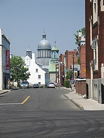
[edit]The city's main thoroughfare is Boulevard des Forges, an area several blocks long in the heart of the Old Town composed of century-old buildings housing a great variety of cafés, restaurants, clubs, bars, and shops. In the warmer months, the area is regularly closed to vehicular traffic to accommodate various festivals and events, turning the downtown core into apedestrian mall.
Notable landmarks include theForges du Saint-Maurice,afoundrydating back to the 1730s, theUrsulinesMonastery, andNotre-Dame-du-Cap Basilica.
-
 TheSieur de Laviolette,founder of Trois-Rivières. TheLaviolette Bridgeis his namesake.
 -
 Architecture in old Trois-Rivières.
 -
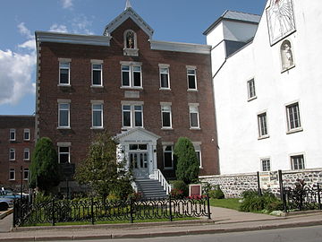 The front of the Ursulines Monastery, onrue des Ursulines.


Sports
[edit]Trois-Rivières has an internationally known racetrack namedCircuit Trois-Rivières.The track has hostedAmerican Le Mans Series,SCCA Pro RacingTrans-Am Series,Star Mazda Series,World RX of Canadaand theNASCAR Canadian Tire Seriesevents.[43]
Inbaseball,Trois-Rivières is represented by theFrontier League'sTrois-Rivières Aigleswhich play their home games atStade Quillorama.In professionalice hockey,the city is host to theECHL'sTrois-Rivières Lions(farm team of theMontreal Canadiens) beginning with the 2021–22 season, and has had several teams in theLigue Nord-Américaine de Hockey,typically with home games at theColisée de Trois-Rivières.The city is also the site of the only remaining pari-mutuel (wagering) harness racing track in Quebec, Hippodrome de Trois-Rivières, which operates live standardbred racing from May through October. In 2014, the hippodrome has resurrected thePrix d'Été,a once major Canadian race for four-year-old pacers that had been contested in Montreal until 1992.
Government
[edit]City council
[edit]Since its incorporation in 1845, the city has had thirty-six mayors. The mayor presides over theTrois-Rivières City Council.
Municipal reorganization
[edit]On January 1, 2002, the former city of Trois-Rivières along with its neighbouring towns ofCap-de-la-Madeleine,Sainte-Marthe-du-Cap,Saint-Louis-de-France,Trois-Rivières-Ouest,and the municipality ofPointe-du-Lac,were combined to form the new city of Trois-Rivières.
| Year | Liberal | Conservative | Bloc Québécois | New Democratic | Green | ||||||
|---|---|---|---|---|---|---|---|---|---|---|---|
| 2021 | 28% | 19,974 | 28% | 19,985 | 30% | 21,061 | 10% | 7,145 | 1% | 908 | |
| 2019 | 26% | 19,005 | 24% | 17,976 | 29% | 21,673 | 17% | 12,655 | 2% | 1,841 | |
| 2015 | 30% | 20,814 | 19% | 13,001 | 17% | 11,943 | 32% | 22,131 | 2% | 1,205 | |
| Year | CAQ | Liberal | QC solidaire | Parti Québécois | |||||
|---|---|---|---|---|---|---|---|---|---|
| 2018 | 46% | 33,676 | 21% | 15,308 | 15% | 11,329 | 14% | 10,429 | |
| 2014 | 28% | 20,319 | 36% | 26,938 | 7% | 5,020 | 28% | 20,661 | |
Infrastructure
[edit]
Local bus service is provided by theSociété de transport de Trois-Rivières.TheLaviolette Bridgelinks Trois-Rivières toBécancourof theCentre-du-Québecadministrative region on the south shore of theSaint Lawrence River.The Laviolette Bridge is the only bridge across the Saint Lawrence River betweenMontrealandQuebec City;therefore it provides an important connection between the north and south shores of the river. Known for its impressive structure, its elegant aesthetics, the bridge has become a major landmark of Trois-Rivières and theMauricieregion. Approximately 40,000 vehicles cross the bridge each day. Anairportalso serves the city.
Passenger rail service was provided toTrois-Rivières stationas recently as 1990, but was suspended as part of service cuts byVia Rail.However, in 2022 Via Rail proposed adding passenger rail service again to Trois-Rivières as part of itsHigh Frequency Railproject that would linkToronto,Ottawa,MontréalandQuébec City.
On April 8, 2014, during morning commute an SUV fell into a giant pothole in Trois-Rivières caused by heavy rain accumulation. Nobody was injured during the incident.[46]
The city hosts a major ice-free port on the Saint Lawrence River, handling about 300 ships per annum.[47]
Education
[edit]Trois-Rivières is home to theUniversité du Québec à Trois-Rivières,and the Mauricie Campus of theUniversité de Montréal,a satellite campus for the university's faculty of medicine.[48]
Media
[edit]Notable people
[edit]- Claude-Jean Allouez
- Jean-Baptiste Badeaux
- George Baptist
- Jacques Baudry de Lamarche
- Guillaume Baudry
- Jean-Baptiste Baudry
- Jean-Christophe Beaulieu
- Pierre-Stanislas Bédard
- Norman Iceberg
- Steve Bégin
- Claude-Michel Bégon de la Cour
- Jean Béliveau
- Mathew Bell
- Marc-André Bergeron
- Amable Berthelot
- Guy Bertrand
- François Bigot (royal notary)
- Raymond Blaise Des Bergères de Rigauville
- Louis-Charles Boucher de Niverville
- Pierre Boucher
- Marc-Antoine Bras-De-Fer de Chateaufort
- François-Joseph Bressani
- Ralph Burton
- Jacques Buteux
- Edward Carter (Canadian politician)
- François de Champflour
- Pierre Chastellain
- Thomas Coffin (pre-confederation Canadian politician)
- John Conley
- Thomas Cooke (bishop)
- Gilles Courteau
- Guillaume Couture
- Antoine de Crisafy
- Lemuel Cushing
- Jean Bouillet de la Chassaigne
- Jacques De Noyon
- Joseph Denis
- Médard des Groseilliers
- Jean Desfossés
- François Desjordy Moreau de Cabanac
- Jean-Baptiste-Éric Dorion
- Josué Dubois Berthelot de Beaucours
- Josephte Dufresne
- Pierre-Benjamin Dumoulin
- Maurice Duplessis
- André Dupont
- Henry Edward Clarke
- Madeleine Ferron
- Peter Frederick Haldimand
- Marie-Anne Gaboury
- François de Galiffet de Caffin
- Pierre Gaultier de Varennes, sieur de La Vérendrye
- René Gaultier de Varennes
- Charles-Borromée Genest
- Samuel Genest
- René Godefroy, sieur de Linctot
- Gérald Godin
- William Grant (fur trader)
- François Gravé Du Pont
- Edward Greive
- Annie Groovie
- Jean Grou
- Bartholomew Gugy
- Conrad Gugy
- Louis Gugy
- Guillaume Guillemot
- Frederick Haldimand
- Benjamin Hart (businessman)
- Aaron Hart
- Moses Hart
- Ezekiel Hart
- William Henry Lee
- Jean-Baptiste Hertel de Rouville
- Jean-Baptiste-Melchior Hertel de Rouville
- Joseph-François Hertel de la Fresnière
- Henry Judah
- Simon Kean
- René-Joseph Kimber
- Joseph de La Roche Daillon
- Urbain Lafontaine
- Claude G. Lajoie
- Nicolas-Eustache Lambert Dumont
- Alexandre Landry
- Alexandre Landry
- Sieur de Laviolette
- Étienne Le Blanc
- Joseph-Dominique-Emmanuel Le Moyne de Longueuil
- Paul-Joseph Le Moyne de Longueuil
- Félix Leclerc
- John Lees (politician)
- Charles Legardeur de Tilly
- Michel Leneuf de la Vallière de Beaubassin
- Jacques Leneuf de La Poterie
- Thomas-Jean-Jacques Loranger
- Alexander MacKay (fur trader)
- Constant le Marchand de Lignery
- Louis-Philippe Mariauchau d'Esgly
- Eisha Marjara
- Martyr
- Dominique Mondelet (seigneur)
- Jean-Marie Mondelet
- Nicholas Montour
- Charles le Moyne de Longueuil et de Châteauguay
- Charles le Moyne de Longueuil, Baron de Longueuil
- The New Cities
- Louis-Philippe Normand
- Édouard-Louis Pacaud
- Phillip Louis (Phil) Perew
- Joseph-François Perrault
- Étienne Pézard de la Tousche Champlain
- Antoine Polette
- François Poulin de Francheville
- François Provost
- Serge Quesnel
- Pierre-Esprit Radisson
- Claude de Ramezay
- Étienne Ranvoyzé
- Ghyslain Raza
- Charles Richard Ogden
- Louis-François Richer Laflèche
- Frederika Charlotte Riedesel
- François-Pierre Rigaud de Vaudreuil
- Pierre de Rigaud, Marquis de Vaudreuil-Cavagnial
- René Robert
- Louis Roy
- Pierre de Sales Laterrière
- James Smith (1806–68)
- Paul St-Pierre Plamondon
- Jean-Guy Talbot
- Luc Tardif
- Éric Thériault
- William Thompson (general)
- Luc Tousignant
- Joseph-Édouard Turcotte
- Richard Vallée
- Joseph-Rémi Vallières de Saint-Réal
- Doris Veillette
- Pierre Vézina
- Jean Victor Allard
- Denis Villeneuve
- Henri Wittmann
- Mikaël Zewski
Sister cities
[edit]This sectionneeds additional citations forverification.(May 2015) |
- Châteaudun,France
- Tours,France

See also
[edit]- 1925 Charlevoix–Kamouraska earthquake
- École secondaire Chavigny
- Évêques-de-Trois-Rivières Mausoleum
- List of population centres in Quebec
- List of regional county municipalities and equivalent territories in Quebec
- List of towns in New France
- List of towns in Quebec
- Marcel-Léger Ecological Reserve
- Millette River
Notes
[edit]Explanatory notes
[edit]- ^Climate data was recorded atCap-de-la-Madeleinefrom December 1920 to April 1932 and at Trois-Rivières from November 1934 to present.
- ^Statistic includes all persons that did not make up part of a visible minority or an indigenous identity.
- ^Statistic includes total responses of "West Asian" and "Arab" under visible minority section on census.
- ^Statistic includes total responses of "Chinese", "Korean", and "Japanese" under visible minority section on census.
- ^Statistic includes total responses of "Filipino" and "Southeast Asian" under visible minority section on census.
- ^Statistic includes total responses of "Visible minority,n.i.e."and" Multiple visible minorities "under visible minority section on census.
Citations
[edit]- ^"Trois-Rivières".Geographical Names Data Base.Natural Resources Canada.RetrievedOctober 12,2021.
- ^"Banque de noms de lieux du Québec:Reference number 63803 ".toponymie.gouv.qc.ca(in French).Commission de toponymie du Québec.
- ^"Répertoire des municipalités:Geographic code 37067 ".mamh.gouv.qc.ca(in French). Ministère des Affaires municipales et de l'Habitation.
- ^abcdGovernment of Canada, Statistics Canada (October 26, 2022)."Census Profile, 2021 Census of Population".www12.statcan.gc.ca.Archivedfrom the original on February 8, 2023.RetrievedJanuary 14,2023.
- ^abc"Census Profile, 2021 Census of Population - Profile table - Trois-Rivières, Quebec, [Census metropolitan area]".December 16, 2022.Archivedfrom the original on February 9, 2023.RetrievedJanuary 24,2023.
- ^abc"Census Profile, 2021 Census of Population - Profile table - Trois-Rivières, Quebec, [Population centre]".December 16, 2022.Archivedfrom the original on January 24, 2023.RetrievedJanuary 24,2023.
- ^includes Trois-Rivières, Bécancour, Champlain, Saint-Luc-de-Vincennes, Yamachiche, Saint-Maurice and Wôlinak
- ^"Table 36-10-0468-01 Gross domestic product (GDP) at basic prices, by census metropolitan area (CMA) (x 1,000,000)".Statistics Canada.January 27, 2017.Archivedfrom the original on January 22, 2021.RetrievedApril 27,2021.
- ^Trois RivièresArchivedNovember 10, 2018, at theWayback MachineatThe Canadian Encyclopedia,accessed September 7, 2019
- ^Roy-Sole, Monique. "A Tale of Tenacity",Canadian Geographic Magazine,April 2009, Vol. 129, No. 2, p. 31.
- ^Territorial Division ActArchivedSeptember 26, 2018, at theWayback Machine.Revised Statutes of QuebecD-11.
- ^untitled[dead link]
- ^Report Concerning the Archives of Canada for the year 1905.Vol I. of III., p. li.
- ^Lamontagne, Léopold (1966)."LENEUF DE LA POTERIE, JACQUES".Dictionary of Canadian Biography, vol. 1.University of Toronto/Université Laval, 2003–.Archivedfrom the original on December 23, 2019.RetrievedDecember 1,2019.
- ^Richard Preston,Canada's RMC: A History of the Royal Military College of Canada,U of Toronto Press for RMC Club.
- ^"Parc de l'île Saint-Quentin (Québec, Canada)".Parc de l'île Saint-Quentin (Québec, Canada).Archivedfrom the original on September 24, 2023.RetrievedNovember 1,2017.
- ^Trois-Rivières, Ville de."Accueil - Site officiel de la Ville de Trois-Rivières".Ville de Trois-Rivières.Archivedfrom the original on September 5, 2008.RetrievedJune 16,2004.
- ^abcd"Trois-Rivières".Canadian Climate Normals 1981–2010.Environment and Climate Change Canada.October 31, 2011.RetrievedMay 12,2014.
- ^"Daily Data Report for July 1953".Canadian Climate Data.Environment and Climate Change Canada.October 31, 2011.Archivedfrom the original on January 13, 2017.RetrievedJanuary 11,2017.
- ^"Daily Data Report for February 1923".Canadian Climate Data.Environment and Climate Change Canada. October 31, 2011.Archivedfrom the original on January 13, 2017.RetrievedJanuary 11,2017.
- ^"Cap De La Madeleine".Canadian Climate Data.Environment and Climate Change Canada. October 31, 2011.RetrievedJanuary 11,2017.
- ^"Trois Rivieres".Canadian Climate Data.Environment and Climate Change Canada. October 31, 2011.RetrievedJanuary 11,2017.
- ^"Daily Data Report for December 2015".Canadian Climate Data.Environment and Climate Change Canada. October 31, 2011.RetrievedJanuary 11,2017.
- ^"Nicolet".Canadian Climate Normals 1981–2010.Environment and Climate Change Canada.RetrievedJanuary 11,2017.
- ^"Ville de Trois-Rivières".Laville.v3r.net. Archived fromthe originalon June 9, 2012.RetrievedJuly 7,2012.
- ^"2021 Census Profile-Trois-Rivières, Ville".Archivedfrom the original on December 14, 2022.RetrievedDecember 14,2022.
- ^"NHS Profile, Trois-Rivières, V, Quebec, 2011".Statistics Canada.May 8, 2013.Archivedfrom the original on December 14, 2022.RetrievedDecember 14,2022.
- ^Government of Canada, Statistics Canada (October 27, 2021)."Census Profile, 2016 Census".www12.statcan.gc.ca.Archivedfrom the original on August 30, 2021.RetrievedJanuary 14,2023.
- ^Government of Canada, Statistics Canada (November 27, 2015)."NHS Profile".www12.statcan.gc.ca.Archivedfrom the original on January 14, 2023.RetrievedJanuary 14,2023.
- ^Government of Canada, Statistics Canada (August 20, 2019)."2006 Community Profiles".www12.statcan.gc.ca.Archivedfrom the original on February 6, 2023.RetrievedJanuary 14,2023.
- ^Government of Canada, Statistics Canada (July 2, 2019)."2001 Community Profiles".www12.statcan.gc.ca.Archivedfrom the original on September 24, 2023.RetrievedJanuary 14,2023.
- ^"Forges du Saint-Maurice National Historic Site of Canada".Parks Canada.Archived fromthe originalon November 20, 2007.RetrievedMarch 27,2009.
- ^Roy-Sole, Monique. "A Tale of Tenacity",Canadian Geographic Magazine,April 2009, Vol. 129, No. 2, p. 32
- ^"Le Port de Trois-Rivières".Archivedfrom the original on August 20, 2007.RetrievedMarch 27,2009.
- ^Roy-Sole, Monique. "A Tale of Tenacity",Canadian Geographic Magazine,April 2009, Vol. 129, No. 2, p. 35
- ^Roy-Sole, Monique. "A Tale of Tenacity",Canadian Geographic Magazine,April 2009, Vol. 129, No. 2, p. 36
- ^Roy-Sole, Monique. "A Tale of Tenacity",Canadian Geographic Magazine,April 2009, Vol. 129, No. 2, p. 37
- ^"Le FestiVoix de Trois-Rivières".Archivedfrom the original on April 13, 2008.RetrievedApril 3,2009.
- ^"Accueil".Festival encore. Archived fromthe originalon July 21, 2012.RetrievedJuly 7,2012.
- ^Roy-Sole, Monique. "A Tale of Tenacity",Canadian Geographic Magazine,April 2009, Vol. 129, No. 2, p. 38
- ^"Tourisme Trois-Rivières".Archived fromthe originalon April 13, 2012.RetrievedFebruary 17,2012.
- ^"Festival International de la Poésie".Archived fromthe originalon March 12, 2018.RetrievedApril 3,2012.
- ^"Grand Prix de Trois-Rivières".Gp3r.Archivedfrom the original on March 2, 2011.RetrievedJuly 7,2012.
- ^"Official Voting Results Raw Data (poll by poll results in Trois-Rivières)".Elections Canada.Archivedfrom the original on March 5, 2023.RetrievedMarch 2,2023.
- ^"Official Voting Results by polling station (poll by poll results in Trois-Rivières)".Elections Québec. December 3, 2021.Archivedfrom the original on August 28, 2023.RetrievedFebruary 28,2023.
- ^"Giant pothole swallows SUV".Archivedfrom the original on April 10, 2014.RetrievedApril 8,2014.
- ^"Port of Trois Riviere".findaport.Shipping Guides Limited.Archivedfrom the original on December 3, 2020.RetrievedDecember 13,2018.
- ^"Mauricie".Université de Montréal.Archivedfrom the original on December 4, 2019.RetrievedDecember 4,2019.
External links
[edit]- (In French)Official site of Trois-Rivières
Adjacent municipal subdivisions | |
|---|---|
| Regional county municipalities andequivalent territories | |
|---|---|
| Municipalities | |
| International | |
|---|---|
| National | |
| Geographic | |
| Other | |