Vanimo
This articleneeds additional citations forverification.(July 2019) |
Vanimo | |
|---|---|
 Vanimo town from the air | |
| Coordinates:2°40′S141°17′E/ 2.667°S 141.283°E | |
| Country | Papua New Guinea |
| Province | Sandaun Province(West Sepik) |
| LLG | Vanimo Urban |
| Elevation | 3 m (10 ft) |
| Population (2013) | |
| • Total | 11,863 |
| • Rank | 16th |
| Time zone | UTC+10(AEST) |
| Mean max temp | 30.6 °C (87.1 °F) |
| Mean min temp | 28.8 °C (83.8 °F) |
| Annual rainfall | 2,797 mm (110.1 in) |
| Climate | Af |
| Location | 1,000 km (620 mi) fromPort Moresby |
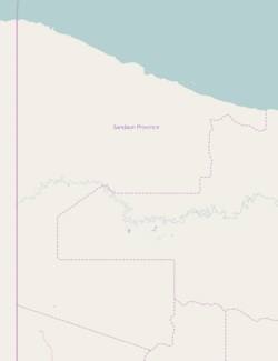
Vanimois the capital ofSandaun Province(West Sepik) in north-westernmostPapua New Guineaand ofVanimo-Green River District.It is located on a peninsula close to theborderwithIndonesia,nearest toJayapura,the capital city ofPapua (province).
Religion
[edit]Its Holy CrossPro-Cathedralis the episcopal see of theRoman Catholic Diocese of Vanimo.[1]
Economy and transportation
[edit]Vanimo is a small township with an economy based around the timber industry. Logging company Vanimo Forest Products, which is owned byMalaysiancompanyRimbunan Hijau,is the chief employer.
There is an airport in Vanimo,Vanimo Airport.
Sports and recreation
[edit]Vanimo is known as asurfingdestination. It has a reputation of having the most consistent waves in Papua New Guinea. Surfing season is mid October through to late April.
Vanimo also is a popular destination for foreign workers in Papua/Indonesia who need to leave the country in order to renew their visas. In this case they come over for a day to visit the Indonesian consulate, stay in one of the hotels along the "sundaun-road" and head back to the border 24 hours later.
The boardriders' club atLido Villagewere the subject of a report onAustralia'sDatelinecurrent affairs program.
Climate
[edit]Vanimo has atropical rainforest climate(KöppenAf). It has very warm to hot and wet weather year round. The average annual rainfall is 2,601 mm (102 in).
| Climate data for Vanimo | |||||||||||||
|---|---|---|---|---|---|---|---|---|---|---|---|---|---|
| Month | Jan | Feb | Mar | Apr | May | Jun | Jul | Aug | Sep | Oct | Nov | Dec | Year |
| Mean daily maximum °C (°F) | 30.6 (87.1) |
30.2 (86.4) |
30.6 (87.1) |
30.9 (87.6) |
31.2 (88.2) |
31.0 (87.8) |
30.7 (87.3) |
30.6 (87.1) |
30.8 (87.4) |
31.4 (88.5) |
31.2 (88.2) |
30.9 (87.6) |
30.8 (87.5) |
| Daily mean °C (°F) | 27.4 (81.3) |
27.2 (81.0) |
27.4 (81.3) |
27.7 (81.9) |
27.9 (82.2) |
27.6 (81.7) |
27.4 (81.3) |
27.3 (81.1) |
27.4 (81.3) |
27.9 (82.2) |
27.3 (81.1) |
27.7 (81.9) |
27.5 (81.5) |
| Mean daily minimum °C (°F) | 24.3 (75.7) |
24.3 (75.7) |
24.3 (75.7) |
24.5 (76.1) |
24.6 (76.3) |
24.3 (75.7) |
24.1 (75.4) |
24.0 (75.2) |
24.1 (75.4) |
24.4 (75.9) |
24.3 (75.7) |
24.5 (76.1) |
24.3 (75.7) |
| Average rainfall mm (inches) | 320.8 (12.63) |
206.8 (8.14) |
265.0 (10.43) |
278.2 (10.95) |
239.3 (9.42) |
216.4 (8.52) |
215.0 (8.46) |
182.8 (7.20) |
128.2 (5.05) |
132.8 (5.23) |
201.4 (7.93) |
214.8 (8.46) |
2,601.5 (102.42) |
| Average rainy days | 19 | 21 | 20 | 18 | 21 | 16 | 18 | 15 | 19 | 17 | 16 | 20 | 220 |
| Source:[2] | |||||||||||||
See also
[edit]References
[edit]- ^http:// gcatholic.org/churches/oceania/2920.htmGCatholic, with Google satellite map
- ^"World Weather Information Service".


