Vulcana-Pandele
Vulcana-Pandele | |
|---|---|
 Gabriel Popescu memorial house in Vulcana-Pandele | |
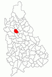
 Location in Dâmbovița County | |
| Coordinates:45°2′N25°23′E/ 45.033°N 25.383°E | |
| Country | Romania |
| County | Dâmbovița |
| Government | |
| • Mayor(2020–2024) | Vasile Radu (PSD) |
Area | 25.08 km2(9.68 sq mi) |
| Elevation | 348 m (1,142 ft) |
| Population (2021-12-01)[1] | 4,683 |
| • Density | 190/km2(480/sq mi) |
| Time zone | EET/EEST(UTC+2/+3) |
| Postal code | 137540 |
| Area code | +(40) 245 |
| Vehicle reg. | DB |
| Website | www |
Vulcana-Pandeleis acommuneinDâmbovița County,Muntenia,Romania.It is composed of four villages: Gura Vulcanei, Lăculețe-Gară, Toculești, and Vulcana-Pandele.
The commune is situated in the southern foothills of theFăgăraș Mountains,at a mean altitude of 348 m (1,142 ft), on the banks of theIalomița Riverand its right tributary, theVulcana.It is located in the northern part of Dâmbovița County, about 8 km (5 mi) south of the town ofPucioasa,and 16 km (10 mi) north ofTârgoviște,the county seat.
Vulcana-Pandele is crossed bynational roadDN71,which starts close toBucharest,runs through Târgoviște, and ends inSinaia,50 km (31 mi) north of the commune. The county road DJJ712 branches off westwards, towards theDâmbovița Rivervalley, where it ends inDN72A.The Vulcana-Pandele train station serves theCFRLine 904,which connectsTitutoPietroșița(passing through Târgoviște).


