
Wadala
Wadala
Vadala | |
|---|---|
neighborhood | |
 Dosti Acres, Wadala East | |
 Wadala | |
| Coordinates:19°01′18″N72°51′53″E/ 19.021632°N 72.86459°E | |
| Country | |
| State | Maharashtra |
| District | Mumbai City |
| City | Mumbai |
| Zone | 4 |
| Ward | F North |
| Government | |
| • Type | Municipal Corporation |
| • Body | Brihanmumbai Municipal Corporation(MCGM) |
| Languages | |
| • Official | Marathi |
| Time zone | UTC+5:30(IST) |
| PIN | 400 031 400 037 |
| Area code | 022 |
| Vehicle registration | MH-01 |
| Lok Sabhaconstituency | Mumbai South Central |
| Vidhan Sabhaconstituency | Naigaon |
Wadala(also spelledVadala,formerly speltWuddala,[ʋəɖaːɭa]) is a neighborhood inMumbai.Wadala Roadis astationon theHarbour LineofMumbai'srailwaynetwork.
Overview
[edit]Wadala has several schools and some renowned institutions likeVeermata Jijabai Technological Institute (VJTI),Institute of Chemical Technology(erstwhile UDCT)),Vidyalankar Institute of Technology(VIT),South Indians' Welfare Society College(SIWS), St.Joseph's High School, and Auxilium Convent High School located near one another. SNDT Women's University, Dr. Ambedkar Commerce & Law College also has a campus in Wadala West. The local college of Wadala is SIWS near the Wadala station. The largest bus depot in Mumbai,BEST's Wadala depot, is located here.
The Ackworth Leprosy Hospital was established during British rule, and part of its complex is now given to anAIDSawareness organisation as well. The world's firstmethanegeneration plant was set up in the Ackworth hospital complex.[1]
History
[edit]Prehistoric
[edit]Wadala village lay on one of theSeven Islands of Bombaythat were joined to form the modern day Mumbai. The island was previously called by different names: Parel, Matunga, Dharavi or Sion.[2][3]
19th century
[edit]The Dadar-Matunga-Wadala-Sion scheme of 1899-1900 was the first planned suburban scheme in Bombay. TheBombay City Improvement Trustwhich was set after a bill was passed in theBritish parliament,formulated this plan in order to relieve congestion in the centre of the town, following theplagueepidemics of the 1890s. According to the survey plan, 85,000 people were to be accommodated in the developments in Wadala.[4]
The plans regulated constructions with emphasis on propersanitation.Buildings were to be three storeys high, and were to have open spaces between them. The land-use was planned to be a mix of residential, commercial and institutional constructions. Parks and gardens were planned, and the streets were well laid out.
440 acres (1.8 km2) of land was procured and leased to the Government for selling. For the first time housing cooperatives were formed to take advantage of newly developed land. The Parsi (Zoroastrian) andHinducolonies inDadar-Wadala were developed in this way.[4]
20th century
[edit]In 1915 the Port Trust Railway opened the WadalaBallard Pierrailway line. Petrol and kerosene installations also came up in Wadala.[5]The Veermata Jijabai Technological Institute (formerly the Victoria Jubilee Technological Institute) moved to its present campus at Wadala in 1923.[6]The Institute of Chemical Technology (formerly the University Department of Chemical Technology) was established in Wadala in 1934.[7]
During theCivil Disobedience Movement,the Wadala Salt Works was raided by around 1,500 volunteers of theCongress partyon 1 June 1930. The incident occurred after an appeal was made in theCongress Bulletinof 31 May, to challenge the 'British anarchy'. The British government in India reacted quickly and 11 women were detained.[citation needed]
Geography
[edit]Wadala was once considered a central suburb of the city of Mumbai, but it is now well within the city limits. The area is bordered byDadaron the West,Matungaon the Northwest andSewrion the South.
The north eastern areas of Wadala are covered by salt pans, which are on the shores of the Thane creek. On the Eastern border of Wadala,MMRDAhas planned to construct a truck terminus, spread over 115 hectares (1.15 km2).
Mumbai will have for the first time a centralized facility for the transport of goods by road.[8][9]
Landmarks and architecture
[edit]


Wadala has a large number of old temples, university campuses and is also home to a former world's largestIMAXdome theater. It is also home to theVidyalankar Educational Campus,whose building design has won an international award viz. Designshare's Honour award.[10][11][12]The BEST Transport Museum is also located at Wadala's Anik bus depot.
It features amateur mini models of BEST buses and the ancient trams.[13]
Wadala is also known for churches, temples anddargas.Near the station is the 400-year-oldVitthalTemple built by SantTukaramwho brought the idol fromPandharpur,home of the original temple of Lord Vithal. The temple is known asPrati Pandharpur(Pandharpur temple's replica). One of the many one-day festivals in Mumbai has been held in this temple to devote Lord Vitthal onAshadhi Ekadashi(According to Hindu Calendar) in June/July.[14][15][16]Near this temple is the 15th-centuryLord Ramtemple and theHanumantemple on the opposite side of the road. The Ram Temple also houses a marriage hall. Located on David S. Baretto Road is a Krishna Temple which also houses an orphanage. Wadala also has aBalajiTemple, that celebrates the Jatra festival each year in the month of January. Apart from these, there is also a Shiv Temple, a Devi Mandir and a small Gurudwara near the station.
TheSt. JosephChurch (Our Lady of Dolours Church) is situated on the D. S. Barretto Road, between Five Gardens and Wadala station. This also houses the St. Joseph's High School. Opposite is the Don Bosco Shelter which is a centre for the rehabilitation and education of underprivileged children. The Barkat Ali Dargah is located on a hill where the bridge connecting Wadala East to Wadala West ends. It is another of Wadala's landmarks.
TheSt. Dominic SavioChurch is located in Wadala East. This church, built in 1981, was the first of Mumbai churches to be situated on the first floor.
Wadala (East) houses two cemeteries, theBaháʼíCemetery and theChineseCemetery. These cemeteries were laid out in Wadala a long time ago, for the same reason that the Ackworth Leprosy Home was built at Wadala viz. Wadala was considered a distant suburb of the city.
A number of housing colonies exist in Wadala. Some of them are Bhakti Park, Dosti Acres, Eucress and Lloyd's Estate. Wadala East also has the BPT (now MbPT housing colony), a large sprawling colony for the port workers complete with a hospital. Near Antop Hill, thegovernment of Indiaestablished theIntellectual PropertyOffice responsible for Controlling General ofPatents,Designs andTrademarksin India.
About 2 kilometers from Wadala Station East, past the truck terminus, is Flamingo Bay. From 1994,lesser flamingoshave been wintering here.[17]From December to March, thousands of flamingos descend on the mudflats, a mile from the shore, to feed on the nutrient-rich marshes. The proposedNhava Shevabridge that will connect the island to the mainland has faced criticism from environmentalists, who allege that the habitat of these birds would be destroyed if the project is approved and completed.[18]
Over the years,slumdevelopment had started in Wadala adjacent to the railway tracks and a large colony began to form. In 2006, thestate governmenttook action and cleared the area of slums.[19]
Utilities
[edit]Wadala receives electricity supplied by theBESTundertaking. Wadala experiences very few electricity cuts in a year, if at all.[20]There are a number of schools, colleges and hospitals. There are police stations in both Wadala West and East. TheVoice of Wadalais the neighbourhood newsletter, in print since 1988.[21]One of the concerns for residents of Wadala is that it does not have any malls or supermarkets. For shopping, one has to use local shops, or travel toMatungaorDadar.[20]
List of schools
[edit]- A. E. S. High School
- Amulakh Amichand School
- Auxilium Convent High School
- Bansidhar Agarwal School
- C. G. E. E. S. High School
- Dadar Parsee Youths Assembly High School
- Dnyaneshwar Vidyalaya
- Don Bosco High School
- J. B. Vachha High School
- Knowledge center (Mumbai School)
- Korba Mithagar Municipal School
- N. K. E. S. High School
- Nadkarni Park Municipal School
- Nirmal Vidyalaya School, Ganesh Nagar
- S. I. W. S. School
- Sitaram Prakash High School
- St. Joseph's High School
List of colleges
[edit]- A. E. S. Junior College of Science & Commerce
- Dr. Ambedkar college of Commerce & Economics
- Kala Saadhna (Classical Dance Music Academy)
- Mumbai College of science and commerce
- Mumbai Institute of Management and Research
- S. I. W. S. School College
- Institute of Chemical Technology(formerly UDCT)
- Vidyalankar Campus (Engineering (UG & PG), Science and Management Colleges)
- Veermata Jijabai Technological Institute(V.J.T.I)
List of hospitals
[edit]- Ackworth Leprosy Hospital
- Aditya Eye hospital
- MbPT Hospital
- Mumbai Port Trust Hospital
- Shobha Maternity Hospital
- Rotunda Nursing Home
Gallery
[edit]-
 Vithhal Mandir, Wadala West
 -
 Our Lady of Dolours Church, Wadala West
 -
 Rocket Garden, Wadala West
 -
 Don Bosco Church, Wadala West
 -
 Indian Patent Office, Wadala East
 -
 UDCT, Wadala West
 -
 Five Garden Area, Wadala West
 -
 Ram Mandir, Wadala West
 -
 Wadala Bridge (Nana Fadnavis Flyover)
 -
 Barkat Ali Dargah, Wadala East
 -
 Nageshwar Mandir, Wadala East
 -
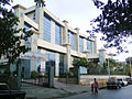
 Vidyalankar Educational Campus, Wadala East
 -
 Hanuman Mandir, Wadala East
 -
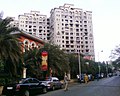 Dosti Acres, Wadala East
 -
 Shaikh Mistry Dargah, Wadala East
 -
 Mumbai Port Trust Railway Yard
 -
 Bhakti Park, Wadala East
 -
 Mangrove Garden, Wadala East
 -
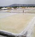 Salt Pan, Wadala East


See also
[edit]References
[edit]- ^Tomar, S.S. (1995).Energy agriculture and environment: with special reference to non-conventional energy sources in development of rural areas.Mittal Publications. pp. 2, The author citesSatianathan, (1975, p.14).ISBN9788170996132.
- ^Gillian Tindall (1992).City of Gold: The Biography of Bombay.Penguin Books India. pp. 27–.ISBN978-0-14-009500-5.
- ^Stephen Meredyth Edwardes(2 June 2011).The Rise of Bombay: A Retrospect.Cambridge University Press. p. 72.ISBN978-1-108-14407-0.
- ^ab"The Dadar-Matunga-Wadala-Sion scheme of 1899-1900".Retrieved25 June2009.
- ^"Mumbai History in the 19th and 20th centuries".Archived fromthe originalon 6 May 2009.Retrieved25 June2009.
- ^"A Brief History of VJTI".Archived fromthe originalon 4 February 2010.Retrieved25 June2009.
- ^"A Brief History of UDCT".Archived fromthe originalon 1 July 2009.Retrieved25 June2009.
- ^"Wadala Truck Terminal, a project by MMRDA".Retrieved25 June2009.
- ^Foo, Ah Foong; Belinda K. P. Yuen (1999).Sustainable cities in the 21st century.Singapore: NUS Press. p. 72.ISBN9789971692285.
- ^"Indian Design Comes of Age".Worldarchitecturenews.7 October 2007. Archived fromthe originalon 3 August 2009.Retrieved1 June2009.
- ^"A work in totality"(PDF).Roof & Facade ASEAN edition.1 August 2007. Archived fromthe original(PDF)on 15 July 2011.Retrieved1 June2009.
- ^R, Priya (16 April 2008)."College shines with campus design".DNA.Retrieved1 June2009.[dead link]
- ^"BEST Transport Museum in Anik Depot".Retrieved25 June2009.
- ^"Faithfuls flock to Wadala temple on Ashadi Ekadashi".Archived fromthe originalon 21 July 2011.Retrieved25 June2009.
- ^"Ashadi Ekadashi: Devotees throng Pandharpur".Sahara Samay Live. Archived fromthe originalon 19 December 2009.Retrieved26 June2009.
- ^"Lakhs throng Pandharpur on Ashadhi Ekadashi".Daily Excelsior.6 July 2008. Archived fromthe originalon 3 January 2007.Retrieved26 June2009.
- ^Ali, Badruddin (2006).Indian Birds Vol.2 November–December 2006(PDF).pp. 1–2. Archived fromthe original(PDF)on 20 July 2011.Retrieved26 June2009.
- ^Menon, Meena (16 July 2005)."Baywatch: Flamingo home in peril - Questions over the Nhava Sewri Trans Harbour sea link to be built at the Sewri Bay of Mumbai".The Hindu.Archived from the original on 25 January 2013.Retrieved26 June2009.
{{cite news}}:CS1 maint: unfit URL (link) - ^Vyas, Sharad; Surendra Gangan (4 April 2006)."Wadala slums seek help"(PDF).DNA.Retrieved25 June2009.[permanent dead link]
- ^ab"Wadala area information".Mid-Day.8 May 2009.Retrieved25 June2009.
- ^"Voice of Wadala Newsletter".Retrieved25 June2009.