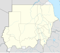
Bestand:Sudan location map.svg
Uiterlijk

Afmetingen van deze voorvertoning van het type PNG van dit SVG-bestand:684 × 600 pixelsAndere resoluties:274 × 240 pixels|548 × 480 pixels|876 × 768 pixels|1.168 × 1.024 pixels|2.336 × 2.048 pixels|1.654 × 1.450 pixels.
Oorspronkelijk bestand(SVG-bestand, nominaal 1.654 × 1.450 pixels, bestandsgrootte: 249 kB)
Bestandsgeschiedenis
Klik op een datum/tijd om het bestand te zien zoals het destijds was.
| Datum/tijd | Miniatuur | Afmetingen | Gebruiker | Opmerking | |
|---|---|---|---|---|---|
| huidige versie | 28 jun 2017 07:17 |  | 1.654 × 1.450(249 kB) | SUM1 | Updated as per 2013 Kurdufan reform |
| 25 jan 2013 11:52 |  | 1.654 × 1.450(245 kB) | NordNordWest | upd | |
| 16 aug 2011 21:46 |  | 1.654 × 1.450(258 kB) | Spesh531 | fixing opacity | |
| 16 aug 2011 21:43 |  | 1.654 × 1.450(258 kB) | Spesh531 | fixing the borders | |
| 16 aug 2011 21:32 |  | 1.654 × 1.450(258 kB) | Spesh531 | adding a disputed territory | |
| 21 jun 2011 20:21 |  | 1.654 × 1.450(241 kB) | NordNordWest | upd | |
| 10 feb 2011 14:17 |  | 1.654 × 1.450(240 kB) | NordNordWest | update, new Sudan | |
| 26 jun 2010 19:16 |  | 1.654 × 1.956(392 kB) | NordNordWest | upd | |
| 22 sep 2009 17:23 |  | 1.654 × 1.956(650 kB) | NordNordWest | ||
| 16 sep 2009 20:17 |  | 1.654 × 1.956(607 kB) | NordNordWest | =={{int:filedesc}}== {{Information |Description= {{de|Positionskarte vonSudan,'''Vorversion'''}} Quadratische Plattkarte, N-S-Streckung 103 %. Geographische Begrenzung der Karte: * N: 23.3° N * S: 3.2° N * W: 21.5° O * O: 39.0° O {{en| |
Bestandsgebruik
Dit bestand wordt op de volgende 32 pagina's gebruikt:
- Ad-Damazin
- Ad-Damir
- Afrikaans kampioenschap voetbal 1957
- Afrikaans kampioenschap voetbal 1970
- Al-Fashir
- Al-Fulah (Soedan)
- Al-Junaynah
- Al-Merrikh Stadion
- Al-Qadarif (stad)
- Al-Ubayyid Stadion
- Atbarah (stad)
- CECAFA Cup 2003
- Dongola (Soedan)
- El Daein
- El Obeid
- Kaduqli
- Kassala (stad)
- Khartoem
- Khartoem-Noord
- Khartoumstadion
- Kosti
- Luchthaven Nyala
- Luchthaven van Khartoem
- Nyala (Soedan)
- Omdurman
- Port Sudan
- Rabak (Soedan)
- Sawakin
- Sennar (stad)
- Wad Madani
- Wadi Halfa-strook
- Sjabloon:Positiekaart Soedan
Globaal bestandsgebruik
De volgende andere wiki's gebruiken dit bestand:
- Gebruikt op ace.wikipedia.org
- Gebruikt op af.wikipedia.org
- Gebruikt op am.wikipedia.org
- Gebruikt op ar.wikipedia.org
- Gebruikt op av.wikipedia.org
- Gebruikt op az.wikipedia.org
- Gebruikt op be-tarask.wikipedia.org
- Gebruikt op be.wikipedia.org
- Gebruikt op bg.wikipedia.org
- Gebruikt op bs.wikipedia.org
- Gebruikt op ce.wikipedia.org
Globaal gebruikvan dit bestand bekijken.


