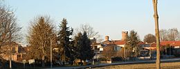
Faule
Aspetto
| Faule comune tagliàne | |||
|---|---|---|---|
 | |||
| |||
| State | |||
| Reggione | |||
| Provinge | |||
| Coordinate | 44°48′00″N 7°35′00″E | ||
| Altitudine | 246ms.l.m. | ||
| Superficie | 6,85km² | ||
| Crestiàne | 461(31-05-2007 (fonte Istat)) | ||
| Denzetà | 67 cr./km² | ||
| Comune 'nzeccate | Casalgrasso,Moretta,Pancalieri(TO),Polonghera,Villafranca Piemonte(TO) | ||
| CAP | 12030 | ||
| Prefisse | 011 | ||
| CodeceISTAT | 004087 | ||
| Cod. catastale | D511 | ||
| Nome javetande | faulesi | ||
| Site istituzionale | |||
Fauleéte 'nu comunetagliánede 403 crestiáne.
Categorije:
- Pagine con argomenti di formatnum non numerici
- Stub
- Prefisso telefonico locale uguale a Wikidata
- Codice ISTAT uguale a Wikidata
- P18 lette da Uicchidate
- P41 lette da Uicchidate
- P94 differende sus Uicchidate
- P281 uguale sus Uicchidate
- P806 uguale sus Uicchidate
- P856 uguale sus Uicchidate
- P2044 uguale sus Uicchidate
- P2046 differende sus Uicchidate
- Comune d'u Piemonte
- Comune d'a provinge de Cuneo
- Pàggene cu le mappe


