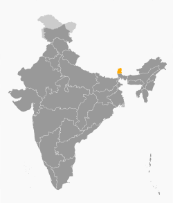
Sikkim
Appearance
Sikkim | |
|---|---|
 Crow's Lake, Sikkim | |
 Location o Sikkim | |
 Cairt o Sikkim | |
| Coordinates (Gangtok):27°20′N88°37′E/ 27.33°N 88.62°ECoordinates:27°20′N88°37′E/ 27.33°N 88.62°E | |
| Kintra | |
| Admission tae Union† | 16 Mey 1975 |
| Caipital | Gangtok |
| Lairgest ceety | Gangtok |
| Destricts | 4 |
| Govrenment | |
| •Govrenor | Shriniwas Dadasaheb Patil |
| •Chief Minister | Pawan Chamling(SDF) |
| •Legislatur | Unicameral(32 seats) |
| •Pairlamentary constituency | Rajya Sabha1 Lok Sabha1 |
| •Heich Coort | Sikkim Heich Coort |
| Area | |
| • Total | 7096 km2(2,740 sq mi) |
| Area rank | 29t |
| Population (2011)[1] | |
| • Total | 607,688 |
| • Rank | 29t |
| • Density | 86/km2(220/sq mi) |
| Time zone | UTC+05:30(IST) |
| ISO 3166 code | IN-SK |
| HDI | |
| HDI rank | 7t (2005) |
| Leeteracy | 82.2% (13th) |
| Offeecial leids | Nepali(lingua franca) Inglis Sikkimese,anLepcha(syne 1977) Limbu(syne 1981) Newari,Gurung,Magar,Sherpa,anTamang(syne 1995) Sunwar(syne 1996) |
| Website | sikkim.gov.in |
| †Assembly o Sikkim abolished monarchy an resolved tae be a constituent unit oIndie.A referendum wis held on these issues an majority o the voters votit yes. On Mey 15, 1975 the Preses o Indie ratified a constitutional amendment that made Sikkim the 22nt state o Indie. | |
Sikkimis a laundlockedstate o Indie,the last tae gie up its monarchy an fully integrate intae Indie, in 1975.
References
[eedit|eedit soorce]- ↑"2011 Census reference tables – total population".Government of India. 2011.Retrieved16 Julie2013.

