
Kenyae
Coordinates:1°N38°E/ 1°N 38°E
Republic o Kenyae Jamhuri ya Kenya(Kiswahili) | |
|---|---|
 Location oKenyae(dark blue) in theAfrican Union(light blue) | |
 | |
| Caipital and largest city | Nairobi 1°16′S36°48′E/ 1.267°S 36.800°E |
| Offeecial leids | |
| Naitional leid | Kiswahili[1] |
| Ethnic groups (2018[2]) | |
| Demonym(s) | Kenyan |
| Govrenment | Unitarpresidentialconstitutionalrepublic |
| Uhuru Kenyatta | |
| William Ruto | |
| Kenneth Lusaka | |
| Justin Muturi | |
| David Maraga | |
| Githu Muigai | |
| Legislatur | Pairlament |
| Senate | |
| Naitional Assemmly | |
| Unthirldom | |
• frae theUnitit Kinrick | 12 December 1963 |
• Republic declared | 12 December 1964 |
| Aurie | |
• Total | 580,367 km2(224,081 sq mi)[3](48t) |
• Water (%) | 2.3 |
| Population | |
• 2017 estimate | 49,125,325[4](28t) |
• 2009 census | 38,610,097[5] |
• Density | 78/km2(202.0/sq mi) (124t) |
| GDP(PPP) | 2018 estimate |
• Total | $175.659 billion[6] |
• Per capita | $3,657.068[6] |
| GDP(nominal) | 2018 estimate |
• Tot | $85.980 billion[6] |
• Per capita | $1,790.014[6] |
| Gini(2014) | 42.5[7] medium·48t |
| HDI(2015) | medium·146t |
| Currency | Kenyan shilling(KES) |
| Time zone | UTC+3(EAT) |
| Date format | dd/mm/yy (AD) |
| Drivin side | caur |
| Cawin code | +254 |
| ISO 3166 code | KE |
| Internet TLD | .ke |
[2]Accordin tae the CIA, estimates for this kintra expleecitly tak intae accoont the effects o mortality acause o AIDS; this can result in lawer life expectancy, heicher infant mortality an daith rates, lawer population an growthe rates, an chynges in the distribution o population bi age an sex, nor wad itherwise be expectit. | |


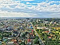
Kenyae,offeecially theRepublic o Kenyae(pronoonced/ˈkɛnjə/) is a kintra inEast Africae,made up o 42 different ethnic tribes. Lyin alang theIndian Oceantae its sootheast an at theequator,Kenyae is bordered biSomalietae the northeast,Ethiopietae the north,Sudantae the northwast,Ugandatae the wast anTanzanietae the sooth.Lake Victoriais tae the soothwast an is shared atween Kenyae,UgandaanTanzanie.Kenyae haes numerouswildlife reserves,containin thoosans o animal species. The caipital ceety isNairobi.The kintra is named efterMunt Kenyae,a significant landmark an seicont amangAfricae's heichest muntain peaks.
-
 Nyeri
Nyeri -
 Eldoret
 -
 Thika
Thika -
 Murang'a
 -
 Coast Province
 -
 Garisa/Garissa
 -
 Garisa/Garissa
 -
 Lodwar
 -
 Kitalé
 -
 Narok
Narok -
 Bomet
Bomet -
 Nanyuki
 -
 Kapenguria
 -
 Maralal
 -
 Crying Stone
 -
 Busia
Busia


References
[eedit|eedit soorce]- ↑abConstitution (2009) Art. 7 [National, official and other languages] "(1) The national language of the Republic is Kiswahili. (2) The official languages of the Republic are Kiswahili and English. (3) The State shall–-–- (a) promote and protect the diversity of language of the people of Kenya; and (b) promote the development and use of indigenous languages, Kenyan Sign language, Braille and other communication formats and technologies accessible to persons with disabilities."
- ↑abCentral Intelligence Agency(2012)."Kenya".The World Factbook.Archived fraethe originalon 31 August 2020.Retrieved28 Mey2013.
- ↑"Demographic Yearbook – Table 3: Population by sex, rate of population increase, surface area and density"(PDF).United Nations Statistics Division. 2012.Retrieved4 September2017.Cite journal requires
|journal=(help)http://unstats.un.org/unsd/demographic/products/dyb/dyb2012.htm - ↑countrymeters.info."Kenya population 2017 – Current population of Kenya".
- ↑"Kenya 2009 Population and housing census highlights"(PDF).Archived fraethe original(PDF)on 10 August 2013.Retrieved22 May2011.Unknown parameter
|deadurl=ignored (help).http:// knbs.or.ke. - ↑abcd"Report for Selected Countries and Subjects (valuation of Kenya GDP)".International Monetary Fund.
- ↑"Human Development Report 2014"(PDF).United Nations. 2014.Retrieved26 Julie2014.
- ↑"2016 Human Development Report"(PDF).United Nations. 2016.Retrieved9 Apryle2017.
| Wikimedia Commons haes media relatit taeKenya. |