
Ensign, Kansas
Ensign, Kansas | |
|---|---|
 Location withinGray CountyandKansas | |
 | |
| Coordinates:37°39′11″N100°13′58″W/ 37.65306°N 100.23278°W[1] | |
| Country | United States |
| State | Kansas |
| County | Gray |
| Founded | 1880s |
| Platted | 1886 (Lone Lake) |
| Incorporated | 1929 |
| Named for | G.L. Ensign |
| Area | |
| • Total | 0.29 sq mi (0.75 km2) |
| • Land | 0.29 sq mi (0.75 km2) |
| • Water | 0.00 sq mi (0.00 km2) |
| Elevation | 2,720 ft (830 m) |
| Population | |
| • Total | 166 |
| • Density | 570/sq mi (220/km2) |
| Time zone | UTC-6(CST) |
| • Summer (DST) | UTC-5(CDT) |
| ZIP code | 67841 |
| Area code | 620 |
| FIPS code | 20-21400 |
| GNIS ID | 2394694[1] |
| Website | cityofensign.com |
Ensignis acityinGray County,Kansas,United States.As of the2020 census,166 people lived there.[3]
History
[change|change source]Ensign was first calledLone Lake,and planned out about 1886. It was renamedEnsignin 1888 in honor of its founder, G. L. Ensign.[4][5]
Geography
[change|change source]Ensign is at37°39′9″N100°13′58″W/ 37.65250°N 100.23278°W(37.652608, -100.232657).[6]
According to theUnited States Census Bureausays that the city has a total area of 0.29 square miles (0.75 km2). All of it is land.[2]
People
[change|change source]| Historical population | |||
|---|---|---|---|
| Census | Pop. | %± | |
| 1930 | 244 | — | |
| 1940 | 202 | −17.2% | |
| 1950 | 227 | 12.4% | |
| 1960 | 255 | 12.3% | |
| 1970 | 237 | −7.1% | |
| 1980 | 209 | −11.8% | |
| 1990 | 192 | −8.1% | |
| 2000 | 203 | 5.7% | |
| 2010 | 187 | −7.9% | |
| 2020 | 166 | −11.2% | |
| U.S. Decennial Census | |||
2020 census
[change|change source]The 2020censussays that there were 166 people, 61 households, and 48 families living in Ensign. Of the households, 86.9% owned their home and 13.1% rented their home.
The median age was 39.0 years. Of the people, 63.9% wereWhite,18.1% were from some other race, and 18.1% were two or more races.HispanicorLatinoof any race were 38.0% of the people.[3][7]
2010 census
[change|change source]The 2010censussays that there were 187 people, 76 households, and 52 families living in the city.[8]
Economy
[change|change source]TheGray County Wind Farmnear Ensign is the largest wind farm in Kansas.
Education
[change|change source]Ensign is a part ofUSD102 Cimarron-Ensign. Ensign had its own high school until 1984.[9]The Ensign High School mascot was Ensign Wildcats.[10]
Notable people
[change|change source]- John Crutcher,former Lieutenant Governor ofKansas.
References
[change|change source]- ↑1.01.11.2U.S. Geological Survey Geographic Names Information System: Ensign, Kansas
- ↑2.02.1"2020 U.S. Gazetteer Files".United States Census Bureau.RetrievedDecember 12,2023.
- ↑3.03.13.2"DP1: PROFILE OF GENERAL POPULATION AND HOUSING CHARACTERISTICS".United States Census Bureau.RetrievedDecember 12,2023.
- ↑Kansas State Historical Society (1916).Biennial Report of the Board of Directors of the Kansas State Historical Society.Kansas State Printing Plant. p. 197.
- ↑"Profile for Ensign, Kansas".ePodunk.Archived fromthe originalon 14 July 2014.Retrieved10 June2014.
- ↑"US Gazetteer files: 2010, 2000, and 1990".United States Census Bureau.2011-02-12.Retrieved2011-04-23.
- ↑"P16: HOUSEHOLD TYPE".United States Census Bureau.RetrievedDecember 31,2023.
- ↑"American FactFinder".United States Census Bureau.Retrieved2012-07-06.
- ↑"Kansas K-12 Reports".Kansas State Department of Education.Retrieved31 December2016.
- ↑"Ensign Cats Nudge Ingalls", Garden City Telegram, 10 February 1962, p.15.
Other websites
[change|change source]- City
- Schools
- USD 102,local school district
- Maps
- Ensign City Map,KDOT
Municipalities and communities ofGray County, Kansas,United States | ||
|---|---|---|
| Cities | 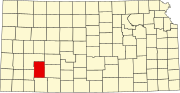 | |
| Unincorporated communities | ||
| Townships | ||