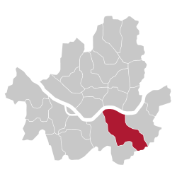
Gangnam District
Appearance
Gangnam-gu
강남구 | |
|---|---|
| 강남구 · giang nam khu | |
 Gangnam Stationarea | |
 Location of Gangnam-gu inSeoul | |
| Coordinates:37°29′48″N127°01′39″E/ 37.49667°N 127.02750°E | |
| Country | |
| Region | Sudogwon |
| Special City | Seoul |
| Administrative dong | 26 |
| Government | |
| • Chief | Shin Yeon-hee |
| Area | |
| • Total | 39.55 km2(15.27 sq mi) |
| Population (2017)[1] | |
| • Total | 561,052 |
| • Density | 14,000/km2(37,000/sq mi) |
| Time zone | UTC+9(Korea Standard Time) |
| Postal code. | 06000 ~ 06499 |
| Area code(s) | +82-2-2226,400,500 |
| Website | gangnam.go.kr |
Gangnam Districtis one of the 25 gu (local government districts) which make up the city ofSeoul,South Korea.Gangnam is Seoul's third biggest district. Themusic videoforPsy's 2012 number one "Gangnam Style"was made in Gangnam District.
