Redford, Michigan
Appearance
Redford Township, Michigan | |
|---|---|
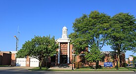
 Redford Township Hall | |
 Location withinWayne County | |
| Coordinates:42°23′41″N83°17′49″W/ 42.39472°N 83.29694°W | |
| Country | |
| State | |
| County | |
| Organized | 1829 |
| Area | |
| •Charter township | 11.24 sq mi (29.11 km2) |
| • Land | 11.24 sq mi (29.11 km2) |
| • Water | 0.0 sq mi (0.0 km2) |
| Elevation | 627 ft (191 m) |
| Population | |
| •Charter township | 49,504 |
| • Density | 4,302.7/sq mi (1,661.3/km2) |
| •Metro | 4,285,832 (Metro Detroit) |
| Time zone | UTC−5(Eastern (EST)) |
| • Summer (DST) | UTC−4(EDT) |
| ZIP code(s) | 48239, 48240 |
| Area code | 313 |
| FIPScode | 26-67625[2] |
| GNISfeature ID | 1626960[3] |
| Website | Official website |
Redford,officially theCharter Township of Redford,is acharter townshipinWayne Countyin theU.S. stateofMichiganand a suburb ofDetroit.The population was 49,504 at the2020 census.[1]
References
[change|change source]


