Vila Real
Appearance
Vila Real | |
|---|---|
|
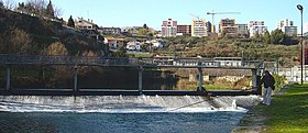
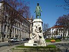
From top left to right:Corgo Rivernear Codessais,Carvalho AraújoStatue,Mateus Palace,St. Peter's Chruch, Quintela Tower and St. Paul's Church (Capela Nova). | |
 | |
| Coordinates:41°17′45″N07°44′46″W/ 41.29583°N 7.74611°W | |
| Country | |
| Region | Norte |
| Intermunic. comm. | Douro |
| District | Vila Real |
| Established | 1289 (city: 1925) |
| Government | |
| •President | Rui Santos (PS) |
| Area | |
| • Total | 378.80 km2(146.26 sq mi) |
| Elevation | 450 m (1,480 ft) |
| Population (2021) | |
| • Total | 49,571 |
| • Density | 130/km2(340/sq mi) |
| Time zone | UTC±00:00(WET) |
| • Summer (DST) | UTC+01:00(WEST) |
| Postal code | 5000 |
| Area code | 259 |
| Website | https://www.cm-vilareal.pt/ |
Vila Real(Portuguese pronunciation:[ˈvilɐ ʁiˈal](![]() listen)) is thecapitalof theVila Real District.It is also largest city in thedistrict.The city is in theNorthregion ofPortugal.The Vila Real has an area of 378.80 km2(146.26 sq mi).[1]In 2021, 49,571 people lived there.[2]
listen)) is thecapitalof theVila Real District.It is also largest city in thedistrict.The city is in theNorthregion ofPortugal.The Vila Real has an area of 378.80 km2(146.26 sq mi).[1]In 2021, 49,571 people lived there.[2]
References
[change|change source]- ↑"Áreas das freguesias, concelhos, distritos e país".Archived fromthe originalon 2018-11-05.Retrieved2018-11-05.
- ↑INE (2022-11-23)."Population and Housing Census - 2021 Census".tabulador.ine.pt.Retrieved2023-01-22.


