Sunflower County, Mississippi
Appearance
Sunflower County | |
|---|---|
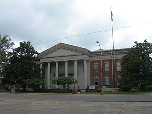
 Sunflower County Courthouse in Indianola, Mississippi | |
 Location within the U.S. state ofMississippi | |
 Mississippi's location within theU.S. | |
| Coordinates:33°37′N90°36′W/ 33.61°N 90.6°W | |
| Country | |
| State | |
| Founded | 1844 |
| Named for | Sunflower River[1] |
| Seat | Indianola |
| Largest city | Indianola |
| Area | |
| • Total | 707 sq mi (1,830 km2) |
| • Land | 698 sq mi (1,810 km2) |
| • Water | 9.2 sq mi (24 km2) 1.3% |
| Population (2020) | |
| • Total | 25,971 |
| • Density | 37/sq mi (14/km2) |
| Time zone | UTC−6(Central) |
| • Summer (DST) | UTC−5(CDT) |
| Congressional district | 2nd |
| Website | www |
Sunflower Countyis acountyfound in theU.S. stateofMississippi.As of the2020 census,25,971 people lived there.[2]Indianolais the largest city andcounty seat.[3]It is in theMississippi Deltaregion.
Sunflower County was created in 1844.
References
[change|change source]- ↑"Soil survey of Sunflower County, Mississippi".USDA. May 17, 1959 – via Google Books.
- ↑"QuickFacts: Sunflower County, Mississippi".United States Census Bureau.RetrievedJanuary 4,2024.
- ↑"Find a County".National Association of Counties.Retrieved2011-06-07.

