Manipur
Itsura
Manipur | |
|---|---|
 Loktak Lake, around 30 km from the capitalImphal | |
 | |
| Country | |
| Formation | 21 January 1972† |
| Capital | Imphal |
| Districts | 16 |
| Pamahalaan | |
| •Governor | Najma Heptulla[1] |
| •Chief Minister | N. Biren Singh(BJP)[2] |
| •Legislature | Unicameral(60 seats) |
| •Parliamentary constituency | Rajya Sabha1 Lok Sabha2 |
| •High Court | Manipur High Court |
| Lawak | |
| • Kabuuan | 22,327 km2(8,621 milya kuwadrado) |
| Ranggo sa lawak | 24th |
| Populasyon (2011[3]) | |
| • Kabuuan | 2,855,794 |
| • Ranggo | 24th |
| • Kapal | 130/km2(330/milya kuwadrado) |
| Sona ng oras | UTC+05:30(IST) |
| Kodigo ng ISO 3166 | IN-MN |
| HDI | |
| HDI rank | 5th (2005) |
| Literacy | 79.85% (16th) |
| Official languages | Meitei(Manipuri)[4][5] |
| Websayt | www.manipur.gov.in |
| †It elevated from the status of Union-Territories by the North-Eastern Areas (Reorganisation) Act 1971 | |
| Language | Meitei |
|---|---|
| Bird | Nongyeen-Syrmaticus humiae |
| Flower | Siroi lily-Lilium mackliniae |
| Tree | Uningthou-Phoebe hainesiana |
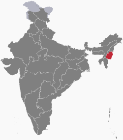
AngManipur(/ˈmʌnɪpʊr/) ay isang estado ngIndia,na may lungsod naImphalbilang kabisera nito.[6]Ito ay pinalilibutan ngNagalandsa hilaga,Mizoramsa timog, atAssamsa kanluran.
Mga sanggunian
[baguhin|baguhin ang wikitext]- ↑Iboyaima Laithangbam (30 Setyembre 2015)."Shanmuganathan sworn in as Manipur Governor".The Hindu.
{{cite news}}:CS1 maint: date auto-translated (link) - ↑BJP leader Biren Singh sworn in as Manipur Chief Minister,India Today (March 15, 2017)
- ↑"Manipur Population Sex Ratio in Manipur Literacy rate data".census2011.co.in.Nakuha noong1 Setyembre2015.
{{cite web}}:CS1 maint: date auto-translated (link) - ↑"At a Glance « Official website of Manipur".
- ↑Abstract of speakers' strength of languages and mother tongues – 2000,Census of India, 2001
- ↑Manipur: Treatise & Documents,Volume 1,ISBN978-8170993995,Introduction
